Dinosaur Doomsday Crater Became an Ocean Oasis for 700,000 Years
10 April 2025 at 06:40
Cores extracted from the impact crater revealed evidence of an ancient, life-nurturing hydrothermal system in the wake of the catastrophe.
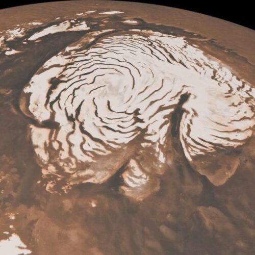
The north pole of Mars is slowly sinking under the weight of an ice cap that only formed within the past few million years. And, in the process, it's telling us something about what the planet's interior must be like, thanks in no small part to data obtained by hardware we landed in Mars' equatorial regions.
That's the conclusion of a new modeling study that produces results that are broadly consistent with earlier work, although quite a bit more detailed. In the process, the work shows how it's possible to take data from radically different data sources and pull them together into a coherent picture.
While the crust of a planet is relatively solid, it bends and breaks in various ways under the strain of plate tectonics. It also flexes in response to ice. The long glacial period that preceded our current interglacial saw sheets of ice that pressed the crust down into the mantle under their difficult-to-conceive weight. With the ice gone, the crust is slowly rising again, in a process called glacial isostatic rebound.
![]()
![]()
© NASA/JPL-Caltech/MSSS
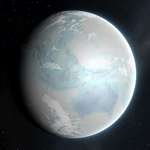
Around 700 million years ago, Earth was a frozen, white sphere, its rocky surface buried kilometers under ice. Despite the barren landscape, the evolution of complex life in the oceans was about to pick up steam. New research published this week in Geology suggests that the two realms were more connected than previously thought.
As massive glaciers scratched and scarred Earth’s rocky surface, they freed less-common minerals, which were later flushed into the seas as the ice melted into giant glacial rivers. These minerals in turn may have spurred nutrient cycling in the oceans, boosting the metabolism of microbial life.
“In retrospect, I’m surprised it took [researchers] so long to go and do a study like this,” says Galen Halverson, a stratigrapher at McGill University who was not involved in the work. “It fits with what we understand” about the glaciated Earth.
![]()
![]()
© MARK GARLICK/SCIENCE PHOTO LIBRARY

For decades, we have been imaging the surface of Mars with ever-finer resolution, cataloging a huge range of features on its surface, studying their composition, and, in a few cases, dispatching rovers to make on-the-ground readings. But a catalog of what's present on Mars doesn't give us answers to what's often the key question: how did a given feature get there? In fact, even with all the data we have available, there are a number of major bits of Martian geography that have produced major academic arguments that have yet to be resolved.
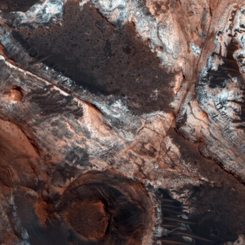
In Monday's issue of Nature Geoscience, a team of UK-based researchers tackle a big one: Mars' dichotomy, the somewhat nebulous boundary between its relatively elevated southern half, and the low basin that occupies its northern hemisphere, a feature that some have proposed also served as an ancient shoreline. The new work suggests that the edge of the dichotomy was eroded back by hundreds of kilometers during the time when an ocean might have occupied Mars' northern hemisphere.
To view the Martian dichotomy, all you need to do is color-code a relief map of the Martian surface, something that NASA has conveniently done for us. Barring a couple of enormous basins, the entire southern hemisphere of the red planet is elevated by a kilometer or more, and sits atop a far thicker crust. With the exception of the volcanic Tharsis region the boundary between these two areas runs roughly along the equator.
![]()
![]()
© NASA/JPL-Caltech/Univ. of Arizona
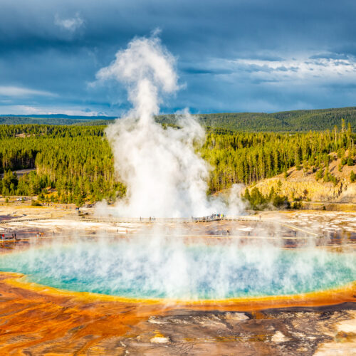
It's difficult to comprehend what 1,000 cubic kilometers of rock would look like. It's even more difficult to imagine it being violently flung into the air. Yet the Yellowstone volcanic system blasted more than twice that amount of rock into the sky about 2 million years ago, and it has generated a number of massive (if somewhat smaller) eruptions since, and there have been even larger eruptions deeper in the past.
All of which might be enough to keep someone nervously watching the seismometers scattered throughout the area. But a new study suggests that there's nothing to worry about in the near future: There's not enough molten material pooled in one place to trigger the sort of violent eruptions that have caused massive disruptions in the past. The study also suggests that the primary focus of activity may be shifting outside of the caldera formed by past eruptions.
Yellowstone is fueled by what's known as a hotspot, where molten material from the Earth's mantle percolates up through the crust. The rock that comes up through the crust is typically basaltic (a definition based on the ratio of elements in its composition) and can erupt directly. This tends to produce relatively gentle eruptions where lava flows across a broad area, generally like you see in Hawaii and Iceland. But this hot material can also melt rock within the crust, producing a material called rhyolite. This is a much more viscous material that does not flow very readily and, instead, can cause explosive eruptions.
![]()
![]()
© Deb Snelson