โŒ

Reading view

There are new articles available, click to refresh the page.

Rare Gulf Coast heavy snow to set records in Houston, New Orleans

A once-in-a-generation snowstorm, tied to the polar vortex event across the Lower 48 states, is plastering the Gulf Coast with record-setting snow and ice on Tuesday.

Why it matters: This region isn't equipped to cope with heavy snow, particularly when it is accompanied by continued cold following the storm.


Threat level: About 3 to 5 inches of snow fell in the Houston metropolitan area, and both the city's major airports shut down for the storm, as did city schools.

  • On Monday night, the NWS forecast office in Houston-Galveston described the storm as a "generational event" that is likely to eclipse the city's second-largest snowstorm on record.
  • The NWS forecast office in Lake Charles, La. issued its first-ever blizzard warning on Tuesday, for the combination of heavy snow and high winds.
  • The snow is moving east Tuesday, and is affecting coastal areas all the way to the Florida Panhandle and southern Carolinas.

New Orleans is also seeing its all-time snowiest day based on modern records taken at their current location. A whopping 8 inches had fallen at Louis Armstrong New Orleans International Airport as of 5pm local time.

  • Videos on social media Tuesday morning showed wind-driven snow falling in Lake Charles as well as New Orleans, with roads covered in snow.
  • Blizzard-like conditions were observed in the New Orleans metro area, with high winds and visibility down to a quarter-mile at times.
  • Snowfall reports ranged from about 5 inches just outside the city to as much as 9 inches already in Lafayette, with snowfall rates of at least an inch-per-hour at times.

This storm could shut down road and air travel along the coastal stretch from Houston to the Florida Panhandle for days due to the lack of snow plowing equipment and the region's inexperience with these winter hazards.

  • Any power outages or other cuts to basic services from the extreme cold and snow could also take days to restore.

Stunning stat: The snow that has fallen so far in New Orleans exceeds the January snowfall so far in the Twin Cities as well as Anchorage, Alaska.

Meanwhile... in Southern California, strong offshore Santa Ana winds have prompted the highest category of red flag warnings for Tuesday.

  • And the Storm Prediction Center has issued an "extremely critical" fire weather outlook for parts of LA and Ventura Counties, as well as parts of San Diego County.
  • The threat may dissipate somewhat Tuesday afternoon local time, but more Santa Ana winds are on the horizon for later this week.

Zoom out: Both the snowstorms, as well as the serious California fire weather threat Tuesday, are tied to the polar vortex-related Arctic blast affecting the majority of the Lower 48 states.

  • Nearly 300 million people in the Lower 48 states were under some type of cold weather warning or advisory as of Tuesday morning.
  • In addition, the strip of winter storm and blizzard warnings stretching from South Texas to Jacksonville, Fla. is something rarely seen, as a low pressure area traverses the central Gulf of Mexico, directing abundant moisture northward, into the frigid air mass.
  • Over longer timescales, studies suggest polar vortex shifts may be more likely due to human-caused climate change, but this is an area of active research.

Also, extreme cold is expected to become less severe in a climate that is warming over time due to the burning of fossil fuels.

Go deeper:

Trump's Paris Agreement withdrawal: second time is not like the first

President Trump's Day 1 move to begin the process of withdrawing the U.S. from the Paris Climate Agreement for a second time sends a clear signal to international partners that the U.S. is hot and cold on climate action.

Why it matters: The world is a very different place today than in 2017, when Trump first moved to have the U.S. depart from the then-nascent agreement.


  • There may be sufficient momentum now in both the Paris regime as well as the burgeoning clean energy sector that this will make only a symbolic difference.

Zoom in: To have the U.S., which is the second-largest emitter behind China, exit the agreement even temporarily has the potential for other countries to start viewing the U.S. as an unreliable partner on climate and potentially other issues as well.

Between the lines: America's withdrawal from Paris doesn't take effect immediately, although the executive order notes the administration will treat it as such.

  • The executive order was written to be far-reaching, cutting off funding for the UN climate organization that oversees annual climate summits and facilitates activities under Paris and other climate agreements since 1992.
  • It would also squelch American contributions to international climate financing that would help countries adapt to climate impacts and boost clean energy production.
  • To become official, it takes one year after U.S. diplomats submit a document to the UN climate bureaucracy notifying them of an intent to withdraw (last time Trump withdrew, it took longer due to a feature in the then-young agreement's provisions.)

There are outstanding questions of whether the Trump administration will continue to send some representatives to the annual climate summits, as it did during his first term, or skip entirely.

The main beneficiary of a U.S. withdrawal and pro-fossil fuels policies domestically could be China, which already leads the U.S. in the clean tech space.

Reality check: Right now, the global community is off track on the road to the Paris Agreement's goals.

  • If the U.S.'s step back from international climate engagement results in a slower decline in global emissions, it would mean even worse climate impacts.
  • It would also ensure that the agreement's 2ยฐC target, which many experts say is still feasible with rapid emissions cuts, could slip.

What they're saying: "There is no sugar-coating this โ€” it will be harmful to global efforts to combat climate change, and so ultimately, also harmful to the future prosperity and security of U.S. citizens," said Kaveh Guilanpour of the Center for Climate and Energy Solutions, in a statement.

  • He noted, though, that the world has been here before, and the agreement survived.

Trump signs slew of sweeping energy executive orders

President Trump signed a blitz of first-day energy-related executive orders on Monday, establishing a national "energy emergency" and setting in motion actions that heavily favor expanding fossil fuel production and generation.

Why it matters: The moves amount to policy whiplash for the energy industry, segments of which had chafed under former President Biden's policies aimed at igniting the renewable sector.


Zoom in: The executive orders include a declaration of a "national energy emergency" aimed at increasing domestic energy production and lowering costs to the consumer.

  • This is partly in response to the rapid AI-related growth of data centers and their energy needs, which the administration views through a national security lens.
  • U.S. power demand is rising quickly after staying largely flat for the last 15 years.
  • One of Trump's initial orders formally rescinds a series of Biden moves that stitched climate and environmental justice throughout federal agency decision-making, going well beyond energy and resource agencies.

This includes a repeal of the Biden administration's Justice 40 Initiative and a 2021 order that set aggressive federal procurement targets for EVs, clean power, low-carbon buildings and more.

The intrigue: Other energy-related orders that Trump signed include steps to halt leasing of large wind farms, and boost oil and gas production.

  • The administration also signed an executive order to boost Alaska's energy production, including by rescinding Biden's 2023 protection of major Alaskan coastal areas from drilling.
  • He also signed an order that attempts to rescind Biden's formal withdrawal of East Coast, West Coast and major offshore Alaskan Arctic areas from drilling.
  • But there's no guarantee producers have much appetite for exploring these regions, and formally selling drilling rights and enabling development would be a complicated bureaucratic and litigious process.

Other actions include seeking to pause funds from being spent under the Biden climate law, and shifting appliance energy efficiency standards back to Trump's first term, before Biden made them more stringent.

Threat level: Trump's attempted reversal of Biden-era policies could boost U.S. greenhouse gas emissions โ€” or at least slow down projected reductions.

Reality check: Trump's "dominance" agenda will also confront market and process barriers โ€” and plenty of litigation.

  • U.S. oil output is already at record levels. Tepid global demand growth makes producers in Texas and elsewhere unlikely to flood the market.
  • Gasoline and diesel costs are tethered to oil prices set on global markets, while electricity costs tend to be highly regional and dependent on weather and other forces.
  • Executive orders can make some instant policy. Often they're a symbolic opening of the long, legally fraught bureaucratic slog of formally unwinding agency rules and policies.

Between the lines: Presidents can use emergency authorities to redirect resources and push the private sector to boost or maintain critical supplies.

  • However, it's likely that the declaration itself will be challenged in court. And its provisions are likely to run into thorny legal issues given that state and regional authorities typically oversee power plant planning and permitting.

Between the lines: The oil and gas industry cheered Trump's opening moves.

  • The good news for those companies extends beyond the energy orders.
  • Trump's holding off for now on sweeping new tariffs that execs fear could raise project costs โ€” and spur retaliation from buyers of U.S. exports.
  • But it may be a temporary reprieve, with Trump instead ordering reviews of trade and currency imbalances.

What they're saying: "By fully harnessing our nation's abundant oil and natural gas resources, we can restore American energy dominance, drive economic prosperity and secure U.S. leadership on the global stage," Mike Sommers, president and CEO of the American Petroleum Institute, said in a statement.

  • But Tiernan Sittenfeld of the League of Conservation Voters said in a separate statement: "It is crystal clear that his administration is all in to pad Big Oil Billionaire profits at the expense of our air, water, lands, climate, health, pocketbooks, and jobs."

The bottom line: The energy-related executive orders will yield some short-term actions on the ground.

  • But it's their longer, topsy-turvy road to implementation that will be crucial to accomplishing the administration's goals.

Trump signs Paris Agreement executive order to withdraw from the pact

President Trump signed an executive order during his first hours in office to begin the process of pulling the U.S. out of the Paris Climate Agreement โ€” the second time he has done so.

Why it matters: The U.S. is the world's second-largest emitter of planet-warming greenhouse gases and top producer of oil and natural gas.


  • Another U.S. departure from the pact would leave a major hole in international efforts to curtail greenhouse gas emissions and potentially call the country's foreign policy credibility into question.

Zoom in: It takes a year for a country to withdraw from the agreement.

  • The Paris Agreement doesn't require countries to cut their emissions, but works through international peer pressure and countries' domestic laws to encourage nations to set ambitious emissions reduction targets.

Under former President Biden, the U.S. had committed to the voluntary goal of cutting emissions economy-wide by 61% to 66% below 2005 levels by 2035.

  • Other countries are setting their own commitments โ€” including China, the world's top emitter and leading nation in renewable energy deployment.
  • Prior to signing the order, the incoming Trump administration described this and other actions on energy as a way to end former Biden's "climate extremism."

Flashback: The U.S. has been here before. Trump pulled the country out of Paris during his first term, only to have former President Biden rejoin the pact on his first day.

  • Then, no other country followed the U.S. move to leave the agreement. The U.N. says 194 nations plus the European Union have joined the pact.
  • Also, the first Trump administration continued to send representatives to the annual climate summits.

Between the lines: Leaving Paris again could cement foreign diplomats' and observers' view of the U.S. as an unreliable partner, given the U-turn from Biden's climate policies.

  • Trump and his nominees have promised to increase fossil fuel production, roll back climate programs that the Biden administration had put in place, and unleash a broad policy of "energy dominance."
  • In addition to the Paris Agreement executive order, Trump signed multiple energy orders that would โ€” if implemented โ€” reorient the U.S. away from a focus on lowering greenhouse gas emissions, and toward increasing oil and gas production and boosting available electricity on the grid.

The intrigue: Trump has long characterized the agreement as putting too much burden on the U.S. compared to other countries.

  • "The United States will not sabotage our own industries, while China pollutes with impunity," Trump said Monday night before signing the executive order.

Reality check: Right now, greenhouse gas emissions are still too high to meet the agreement's temperature targets, even though some country's, including the U.S., have been reducing their emissions.

  • If a U.S. departure were to slow the decline in domestic emissions and cause other countries to balk at taking more aggressive efforts, then it may make it even harder for the targets to be met.
  • The action on Paris comes amid an increase in the severity and frequency of certain extreme weather events, and a little more than a week after climate change-worsened wildfires tore through metro LA, killing at least 27 and destroying more than 10,000 homes.

What they're saying: "By leaving the Paris Agreement, this administration has abdicated its responsibility to protect the American people and our national security," said Gina McCarthy, former White House national climate adviser and now managing co-chair of the "America is All In" coalition.

  • "The U.S. withdrawing from the Paris Agreement is unfortunate, but multilateral climate action has proven resilient and is stronger than any single country's politics and policies," said Laurence Tubiana, a key architect of the Paris Agreement, in a statement.
  • Simon Stiell, the top UN climate diplomat, issued a statement saying any country is welcome to offer "constructive engagement" at future climate talks.

Go deeper:

Climate and energy lessons from Biden's four years

Polar vortex-related Arctic blast brings "dangerous" cold, snow to U.S.

Data: NOAA GFS; Map: Erin Davis/Axios Visuals

An invasion of frigid air from the Arctic is sweeping south from the Plains and Ohio Valley Sunday, moving towards the Southeast and East.

Threat level: The colder-than-average temperatures threatens public health for those exposed to the wind and cold, and may harm water and power infrastructure from North Dakota to Texas, on eastward.


  • The extreme cold has links to the polar vortex, which is a feature of the winter climate during winter in the Northern Hemisphere.
  • "Life-threatening" wind chills down to minus-55ยฐF are likely in the Plains and Upper Midwest, the NWS warns, mentioning the risk of hypothermia and frostbite for people exposed to the cold for too long.
  • Sub-zero wind chills are forecast to affect the Ohio and Tennessee Valley Sunday night through midweek, with the possibility of similar cold spreading into portions of the Mid-Atlantic and Northeast in the wake of a winter storm.

Along with the cold, a snowstorm is affecting areas from the Mid-Atlantic to the Northeast on Sunday into Monday. It is poised to potentially become the heaviest snowstorm so far this year for Philadelphia, New York City and Boston, with 5 to 10 inches possible in this broad region.

What they're saying: "This will be the coldest air of the winter season thus far, and in many cases the coldest in several years," the NWS warns.

Zoom in: The hazardous cold will be especially disruptive in the South and Southeast, where temperature departures from average will be significant and persistent.

  • A rare winter storm is set to deliver a severe snow and ice storm from Houston to Baton Rouge and New Orleans, eastward towards the Carolinas beginning Monday.
  • As of Sunday morning, the National Weather Service was calling for about 3 inches of snow to fall in Houston, with up to 5 inches in parts of the metro area.
  • About 2 to 3 inches of snow are expected to fall in New Orleans, with 4 to 6 inches in Baton Rouge.

The intrigue: The NWS forecast office in New Orleans is urging residents to "Exercise extreme caution if travel cannot be avoided" due to the cold and snow that is expected.

  • "Given the rare southerly track of this winter storm, major traffic and travel disruptions are likely through mid-week," the NWS stated in an online forecast discussion.

By the numbers: Here's how some cities will be affected early next week:

  • Minneapolis: A high of minus-5ยฐF with a low of minus-13ยฐF on Jan. 22.
  • Denver: A high of 6ยฐF and a low of minus-4ยฐF on Jan. 20.
  • Dallas: A high of 33ยฐF and a low of 23ยฐF on Jan. 21.
  • New York City: A high of 18ยฐF and a low of 10ยฐF on Jan. 21.
  • Washington, D.C.: A high of 21ยฐF and a low of 11ยฐF on Jan. 21.

Meanwhile... The Arctic outbreak will result in a blustery and frigid Inauguration Day, with temperatures in the upper teens and wind chills even lower on the National Mall when President-elect Trump takes the oath of office inside the Capitol to protect attendees from the cold.

The intrigue: The cold air may also spill westward into the Great Basin, setting up yet another period of strong, offshore Santa Ana winds in Southern California.

Zoom out: The factors behind this cold outbreak include a strong high pressure area or "ridge" in the jet stream across the eastern Pacific north to Alaska. Meanwhile, there's a dip, or "trough," in the jet stream across central portions of the U.S.

  • This is allowing Arctic air to surge southward.
  • Also, in the upper atmosphere, the polar vortex is currently becoming "stretched" from north to south across the North Pole.
  • It is expanding southward and helping to promote the flow of air from northern Canada southward toward the continental U.S., said Judah Cohen, a meteorologist at Atmospheric & Environmental Research.

Zoom out: The polar vortex in the stratosphere is altering the jet stream one atmospheric layer down, in the troposphere. This is where most weather takes place.

  • This interaction between the polar vortex and the jet stream may be favoring the strong area of high pressure over Alaska and downstream trough, according to Amy Butler, a researcher at NOAA, and Simon Lee of the University of St. Andrews.
  • Both researchers said this interaction is likely to be more short-lived than what happened during the infamous polar vortex winter of 2013-2014.

Over longer timescales, studies suggest polar vortex shifts may be more likely due to human-caused climate change, but this is an area of active research.

Polar vortex-related Arctic blast to send temperatures plunging in U.S.

Data: NOAA GFS; Map: Erin Davis/Axios Visuals

A powerful Arctic outbreak tied in part to the polar vortex is set to send temperatures by next week tumbling down to as cold as 25 to 35 degrees Fahrenheit below average for mid-January, forecasts show.

Why it matters: The hazardous cold could endanger public health, stress electricity grids, damage crops and make for a frigid Inauguration Day.


  • This event is likely to be far colder and more widespread than the Arctic outbreak that occurred earlier this month.

Threat level: Mother Nature's refrigerator door looks to open, with cold air spilling southward out of northern Canada beginning Friday night and lasting for at least a week.

  • Through Sunday, about 81 million people are predicted to see temperatures plunge to below-zero Fahrenheit, and the number affected will increase from there.
  • That's a smaller number compared with the polar vortex winter of 2013-2014. But it will increase after Sunday.
  • "Dangerously cold wind chills" are likely in the Plains and Upper Midwest, the NWS warns, mentioning the risk of hypothermia and frostbite for people exposed to the cold for too long.

Zoom in: The hazardous cold will be especially disruptive in the South and Southeast, where temperature departures from average will be significant.

  • The region also may see a snow and ice storm midweek next week.

The Arctic outbreak is likely to result in a blustery and frigid Inauguration Day, with temperatures in the mid-20sยฐF and wind chills in the teens on the National Mall when President-elect Trump takes the oath of office.

By the numbers: Here's how some cities may be affected early next week:

  • Minneapolis: A high of minus-6ยฐF with a low of minus-14ยฐF on Jan. 20.
  • Denver: A high of 7ยฐF and a low of minus-5ยฐF on Jan. 20.
  • Dallas: A high of 34ยฐF and a low of 21ยฐF on Jan. 20.
  • Washington, D.C.: A high of 26ยฐF and a low of 20ยฐF on Jan. 20.

Between the lines: The factors behind this cold outbreak include a strong high pressure area or "ridge" in the jet stream across the eastern Pacific north to Alaska. Meanwhile, there's a dip, or "trough," in the jet stream across central portions of the U.S.

  • This will allow Arctic air to surge southward, Zack Taylor, a forecaster at NOAA's Weather Prediction Center in College Park, Md., told Axios.
  • There's also a connection to the tropospheric polar vortex, which is distinct from the higher-level, stratospheric polar vortex.
  • The latter feature of the Northern Hemisphere winter climate is currently becoming "stretched" from north to south across the North Pole, but it is not breaking into pieces and surging towards the Lower 48 states as it did in 2014.
  • Instead, the stretched vortex is expanding southward and helping to promote the flow of air from northern Canada southward toward the continental U.S., said Judah Cohen, a meteorologist at Atmospheric & Environmental Research.

Zoom out: In the troposphere, at about the same height that jet aircraft cruise, a lobe or multiple pieces of ultra-cold air may enter the U.S. while rotating around Hudson Bay, Canada.

  • These could result in some of the most extreme cold temperature anomalies of this event.
  • In a sign of the magnitude of the cold air on tap for the U.S., computer models are projecting a record strong area of high pressure over Missouri to form early next week, Taylor said.

Context: Studies suggest polar vortex shifts may be more likely due to human-caused climate change, but this is an area of active research.

Friction point: But this area of climate science is hotly contested, with new studies supporting and knocking it down appearing each year.

The intrigue: While a polar vortex event was much-advertised earlier in January, air temperatures turned out to be milder than anticipated.

  • That's not likely to be the case this time, however, Taylor said.
  • "The weather pattern just looks so much better than it did compared to a week or so ago," he said, referring to the opportunity for extreme cold.
  • He noted wind chills could plunge to minus-30ยฐF to minus-40ยฐF in the Upper Midwest and Plains, and even reach below zero in the Southern Plains, Ohio Valley, Gulf Coast and Mid-Atlantic early next week.
  • The cold air is likely to be persistent along the Gulf Coast, Taylor said.

It is not expected that this event will break dozens of records, in part because it can be hard to break cold temperature records at this time of year.

Go deeper: Abnormally cold weather forecast for Trump's inauguration

Why LA wildfires forecasts alone couldn't stop the death toll

The deadly Los Angeles area fires show what can go horribly wrong even when weather forecasts and warnings prove eerily prescient.

Why it matters: Weather forecasters are struggling with how to communicate the dangers of extreme weather events as those events increase in frequency and ferocity with human-caused climate change.


  • This involves a mix of meteorology and climate science, along with social science research into how people respond to warning language and official advice.

The big picture: It's unclear if the public fully grasps the meaning of the National Weather Service's fire weather warnings or the criteria behind its terms, Stephen Bieda, chief of the service's Severe, Fire, Public and Winter Weather Services Branch, told Axios.

  • "There is a larger-scale conversation going on" about better aligning NWS' products with input from communications and social science professionals, he said.

Zoom in: There are some eerie similarities between the firestorm that began to engulf portions of LA County on Jan. 7 and recent hurricanes โ€” such as Ian and Helene โ€” that were accurately forecast but still led to a large loss of life.

  • In the case of Ian, some late shifts in the storm's path occurred, but it remained within the so-called "cone of uncertainty." Yet many were caught off guard when a storm surge roared across Sanibel Island and into Fort Myers Beach, killing dozens.
  • The fires began during a period when the National Weather Service was practically screaming about the fire threat from a rare high wind event in ALL CAPS text.

The consensus was that any fire start could grow "explosively" and be nearly impossible to contain even with the pre-staging of fire crews.

  • Sadly, four such fires occurred around the same time, overwhelming responders, many of whom had been prepositioned to act quickly.

Context: Red flag warnings were initially created for emergency managers and land management agencies in the 1990s, Bieda said.

  • Similarly, "Particularly Dangerous Situation" Red Flag warnings were implemented about five years ago โ€” again primarily for the emergency management community to increase readiness rather than the public.
  • But, given the accessibility of information, those warnings are widely consumed, Bieda said.
  • He said their basic message is that forecasters have the highest-possible confidence that a worst-case combination of dry vegetation, or fuels, and strong winds will occur to produce a potentially devastating event.

Friction point: According to Amanda Stasiewicz, a researcher at the University of Oregon, and Stephanie Hoekstra, a wildfire social scientist at CIRA and NOAA, it's one thing to tell people to be prepared for potentially dire fire weather conditions.

  • But pinpointing fire ignitions ahead of time isn't currently possible โ€” and they said that may limit forecasts' utility.
  • "You never know where the next fire is going to break out," Hoekstra told Axios. "Something that makes fires unique is that anywhere can be ground zero."

Both Stasiewicz and Hoekstra told Axios that so-called PDS Red Flag warnings are currently only used by some NWS forecast offices, including the LA office.

  • They're geared mainly to partners of the NWS such as emergency management agencies and elected officials at the state, regional and local levels.
  • Little research has been done on how they affect public preparation and response.

Between the lines: Social scientists who study responses to extreme weather watches and warnings โ€” as well as evacuation orders โ€” are limited by a lack of studies on wildfires, said Julie Demuth, who studies weather risks and decisions at the National Center for Atmospheric Research.

  • "A major challenge we have with answering these questions is that we often don't have the social science 'observations' we need to answer these event-specific questions," she told Axios via email.
  • Even evidence gleaned from other fire-prone areas is relatively sparse, Demuth and other experts told Axios.

The intrigue: The NWS proactively anticipated the fire weather threat on Jan. 7, as well as the ongoing threat Tuesday through Wednesday.

  • The first briefing for emergency managers on the Jan. 7 fire danger took place on New Year's Day, a Weather Service spokesperson said.
  • The service's LA office began briefings the next day but had first mentioned the threat in its forecast products as early as Dec. 30.
  • Watches and warnings were hoisted beginning four days in advance of the event, NOAA's timeline states.

What's next: Its potential shortcomings aside, the Weather Service's most dire fire weather warning, the PDS Red Flag Warning, is in effect for parts of LA and Ventura Counties through Wednesday at noon.

Go deeper:

Climate change plays key contributing role in LA fires

New, rare fire warning issued in Southern California

The psychological toll of California's catastrophic fires

Southern California faces rare fire warning

Firefighters battling the Los Angeles-area fires are facing fresh threats nearly a week after wildfires erupted across the region, fueled by powerful Santa Ana winds in extremely dry conditions.

Threat level: The National Weather Service's LA forecast office Sunday evening issued a rare "Particularly Dangerous Situation" Red Flag Warning lasting until Wednesday at noon for parts of L.A. and Ventura counties, warning that high winds could cause "explosive fire growth."


Screenshot: National Weather Service Los Angeles/x
  • The weather service advised residents "to have multiple ways to receive evacuation information" and to "not do anything that could spark a fire."
  • Areas under this warning don't include the Eaton Fire but cover western Santa Monica, Simi Valley, Porter Ranch, Ventura and other parts of the hard-hit region.

Zoom in: Winds during this event will be closer to a typical strong Santa Ana, at 50 mph to 70 mph instead of up to 100 mph as seen last week.

  • But the east-to-west air flow will likely target areas that didn't have such strong winds last week, particularly in Ventura County.
  • "THIS IS A PARTICULARLY DANGEROUS SITUATION (PDS) FOR PORTIONS OF LOS ANGELES AND VENTURA COUNTIES!" the NWS said in all caps.
  • Much of Southern California is under some type of Red Flag Warning, with areas of "Extremely Critical" fire weather risk โ€” the highest category from the Storm Prediction Center (SPC), from Monday through Wednesday.
Image showing the criteria for ordering a Particularly Dangerous Situation Red Flag Warning. Image: NWS
  • According to SPC, which issues fire weather outlooks nationally, about 740,000 people are included in the extremely critical area on Monday.
  • About 8.1 million are located in the "critical" fire weather risk classification, which is just below the maximum alert level.

Between the lines: According to the NWS LA office, before this season, the "PDS" classification had only been used twice before. Both were in 2020.

  • However, the warning type has only been in existence for about half a decade.
  • The product is supposed to indicate rare events, but the extraordinarily dry start to the winter wet season this year has meant that the fire season has stretched much deeper into the winter than usual.
  • This means it overlaps with more high wind events, which is something that climate studies show occurring with greater regularity in coming decades.

Yes, but: The Eaton and Palisades fires aren't included in the particularly dangerous situation portions of the warnings, according to the NWS, but nearby areas are and the heightened concerns relate to new fire starts as well.

The big picture: The region is suffering from hydroclimate whiplash worsened by human-caused climate change.

  • Much of Southern California has received virtually no rain in the past eight months.
  • And seven-day precipitation forecasts don't show measurable rain during the next week, despite January being well into the typical rainy season.

More from Axios:

Editor's note: This a breaking news story. Please check back for updates.

Wildfires death toll rises to 24 as L.A. area faces fresh threats

Los Angeles County is facing "critical fire conditions" after firefighters have for days battled deadly wildfires that have razed entire neighborhoods, and the situation is expected to worsen this week.

Threat level: The National Weather Service issued a rare "Particularly Dangerous Situation" red flag warning that's due to start early Tuesday into Wednesday for parts of L.A. County and Ventura County, warning that winds will be high enough to cause "explosive fire growth."


  • The areas under this warning do not include the Eaton Fire, but do include western Santa Monica, Simi Valley, Porter Ranch, Ventura and other parts of the hard hit region.
  • The winds will not be as strong as the previous event but strong enough to meet the high-end criteria.

The big picture: The death toll rose to at least 24, per the L.A. County medical examiner's Sunday evening update. Another 16 people have been reported as missing, Los Angeles County Sheriff Robert Luna said during a Sunday briefing.

  • More than 100,000 residents remain under evacuation orders and over 12,000 structures have been destroyed.

Situation report: The Kenneth, Sunset and Lidia fires have been 100% contained, Gov. Gavin Newsom said in a Sunday update.

  • The Hurst Fire was at 89% containment Sunday evening, per Cal Fire.
  • The Palisades and Eaton fires, the biggest of the blazes, were 13% and 27% contained, respectively.
  • Sixteen of the reported deaths have been attributed to the Eaton Fire, while the remaining eight have been categorized with the Palisades Fire.
  • Newsom announced he's deployed a further 1,000 California National Guard personnel to the Los Angeles area, taking the number assisting in firefighting efforts to 2,500.
Screenshot: NWS Los Angeles/X

State of play: Red flag warnings for much of Los Angeles and Ventura counties are set to remain in place until Wednesday as gusty winds and low relative humidity persist, the National Weather Service's L.A. office said Sunday evening.

  • NWS expects the offshore Santa Ana winds that have been making fighting the fires extremely difficult to pick back up after a brief reprieve, which could complicate firefighters' efforts to contain the flames.
  • Dry vegetation coupled with "prolonged extreme fire conditions" will support "rapid spread and erratic behavior" of new or existing fires, per NWS. The Eaton Fire may be less affected by strong winds than the other blazes.

By the numbers: Over 35,000 customers in Los Angeles County were without power about 12:30am Monday ET, per PowerOutage.us.

Context: Parts of Southern California are experiencing their driest start on record.

  • An overlap of rare climate factors is in part to blame for the rapidly spreading blazes, as the bone-dry region grapples with the worst high wind event in Southern California since 2011, per Axios' Andrew Freedman.
  • While the fires are not the largest wildfires the state has faced, they are among the most destructive on record.

Go deeper: Why fire hydrants ran dry as wildfires ravaged Los Angeles

Editor's note: This article has been updated with new details throughout.

LA area fires: Climate change playing key contributing, but not sole, role

Climate change โ€” particularly whiplash between two wet winters followed by a bone-dry, unusually hot spring, summer and fall โ€” set the stage for Los Angeles' deadly and devastating fires, scientists say.

  • The firestorm was the product of what climate researchers refer to as "hydroclimate whiplash."
  • Other factors include one of the worst Santa Ana wind events of the past two decades; land use patterns; and sparks set off by power lines, car engines, suspected arsonists and other potential ignition sources.

Why it matters: Whatever the source, it's clear a changing climate made the fires more ferocious, long-lasting and destructive, as has been the trend across the West in recent decades.


Threat level: Though winds are no longer as strong, the overall conditions that led to the extraordinary rates of fire spread haven't abated.

  • That may only come with significant rainfall, which currently isn't in sight.

Zoom in: Hydroclimate whiplash occurs when one extreme precipitation regime is replaced by another.

  • In this case, extremely wet conditions are followed almost immediately by parched weather patterns, typically accompanied by above average temperatures.
  • This leads to a green up of vegetation that then dries out through evaporation, leading to ample "fuels" for a blaze to burn.
  • The strong winds โ€” which reached 99 mph in some locations โ€” acted as an "atmospheric blow dryer" on trees and other vegetation, further drying out the landscape and ensuring any fire wouldn't stay small for long, UCLA climate scientist Daniel Swain said in an online video briefing.

Stunning stat: In downtown Los Angeles, just 0.16 inches of rain has fallen since May 6, compared to the average of greater than 4 inches, per the National Weather Service.

  • This is the city's second-driest May 6 to Dec 31 period on record, according to the National Weather Service's Los Angeles forecast office.
  • No rain is in the forecast through early next week, with one Santa Ana event diminishing this morning, and another potentially strong one forecast for early in the coming week.

Zoom out: The see-saw pattern between wet and dry periods isn't new for Californians. But these swings are becoming acute โ€” and not just in the Golden State.

  • A new study published last week shows these swings are becoming more of a trigger for wildfires, floods and drought globally.
  • In the study, scientists refer to an increasingly "expanding atmospheric sponge," since the atmosphere is able to evaporate, absorb and release 7% more water vapor for every 1ยฐC (1.8ยฐF) that the temperature increases.

In other words, the atmosphere gets more thirsty as the climate warms, drawing more moisture from plants, and leading to more days with extreme fire weather conditions.

  • This analogy captures the atmosphere's ability to absorb a larger and larger amount of water vapor as temperatures increase, and wring out more and more water due to such temperature changes.
  • Data shows this whiplash effect has increased by between 31% to 66% globally since the mid-20th century, and that the rate of increase is speeding up.

Between the lines: If global average temperatures increase by about 3ยฐC (5.4ยฐF) โ€” which is currently likely โ€” then the whiplash effect will more than double in its intensity.

  • "Increasing hydroclimate whiplash may turn out to be one of the more universal global changes on a warming Earth," Swain said in a statement.
  • Though the rare, powerful winds are fanning the blazes, it's the whiplash-driven lack of rain that has trapped Southern California in a seemingly never-ending fire season.
  • In addition to the increased thirstiness of the atmosphere and see-sawing from floods to droughts and back again, studies show that climate change is increasing the odds that windy periods occurring deeper into the traditional "rainy season" will overlap with extreme dryness.
  • This overlap is another crucial tie between the ongoing California fires and long-term, human-caused climate change.

The intrigue: Land management, the use of prescribed burns and expanding building in fire-prone areas have also contributed to this wildfire nightmare. But climate change is a large, and growing factor.

  • "Whether we like it or not, the nature of wildfire in Southern California is changing and we must adapt accordingly," said UCLA climate scientist Alex Hall in a statement.
  • "That will involve some frank conversations about the tradeoffs involved in improving our strategies to reduce ignitions, improve stewardship of our unique chaparral landscapes to reduce impacts, and protect human life and property."

The bottom line: Climate change didn't provide the spark that caused each of these catastrophic fires in LA County. But it's making such fires worse.

Red flag warnings to be issued again as crews battle LA fires

The National Weather Service plans to issue a red flag warning of critical fire weather conditions including gusty winds and low relative humidity, effective Saturday evening through Sunday afternoon, for Los Angeles and Ventura counties, the agency's LA office stated Saturday morning.

The big picture: Historic California wildfires have severely impacted these areas, and the NWS expects offshore Santa Ana winds to pick back up, with another strong offshore event occurring early next week and no rain in sight.


  • Wildfires have seared more than 30,000 acres in Los Angeles County this week, leaving at least 11 people dead, per an update Friday from the Los Angeles County Department of Medical Examiner.

Threat level: With no rain in the forecast, these winds will challenge firefighters battling the ongoing blazes and any new fire starts.

  • Parts of Southern California are experiencing their driest start to the winter "rainy season" on record, after two wet winters encouraged plant growth that has led to ample dry vegetation for fires to burn.

What they're saying: "With continued dry conditions, Red Flag Warnings are likely. While a brief reprieve from the winds are expected Sunday Night, they will form again Monday through Wednesday, with a peak around Tuesday of gusts between 40 and 60 mph," the NWS said.

  • "With humidities plummeting to 5 to 15 percent, there is a high risk for Red Flag Warnings."

More from Axios:

2024: Earth's hottest year and first to exceed Paris target

Data: Copernicus; Chart: Danielle Alberti/Axios

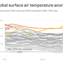
Last year was Earth's warmest on record, eclipsing 2023's record and for the first time exceeding the Paris target of 1.5ยฐC above preindustrial levels, the Copernicus Climate Change Service announced.

Why it matters: While climate scientists don't put too much stock into an individual year's record, the long-term trend is toward more rapid warming, and it is not entirely clear why 2024 was so hot and what it portends.


Map showing surface air temperature anomalies in 2024 compared to 1991-2020 average. Image: Copernicus Climate Change Service

Zoom in: Last year was the hottest seen in instrument record-keeping but also much longer before that.

  • In fact, as with 2023, the year was very likely the hottest in at least 125,000 years.
  • Some daily global average temperatures, as measured using increasingly precise computer model data, exceeded 2ยฐC above preindustrial levels โ€” flirting with another temperature target in the Paris climate agreement.

According to Copernicus, an agency of the European Commission, each year in the last decade has been one of the 10 hottest on record.

  • Global average surface temperatures in 2024 were about 1.6ยฐC above pre-industrial levels, Copernicus found, and about 0.12ยฐC (.22ยฐF) above 2023's record high.
  • Data from U.S. centers, such as NOAA and NASA, show similar results. The World Meteorological Organization, a U.N. agency, also found that the global average surface temperature in 2024 exceeded 1.5ยฐC above preindustrial levels.
  • Berkeley Earth, an independent temperature monitoring group that also released its 2024 data Friday, noted in a report that the record-breaking warmth of the past two years "demonstrates a clear deviation from the long-term warming trend, suggesting that warming rates have increased, at least in the short term."

Yes, but: The Paris Agreement's most stringent temperature target of holding warming to 1.5ยฐC compared with pre-industrial levels refers to a long-term, 20-to-30-year average, rather than a single year or two.

  • Still, 2024 shows the world is already exceeding the barrier that diplomats set at the Paris climate summit in 2015, and in fact the average of 2023 and 2024 falls above the 1.5ยฐC threshold, Copernicus said.
  • Studies show that if warming exceeds 1.5ยฐC relative to preindustrial levels, the odds of potentially catastrophic impacts, such as the shutting of key ocean currents and melting of Arctic and Antarctic ice sheets, would increase considerably.
  • Regarding exceeding the 1.5ยฐC marker, Copernicus' news release stated: "Global temperatures are rising beyond what modern humans have ever experienced."

Reality check: While global leaders are still committed to the 1.5-degree goal, it is partly because of a lack of consensus of what a new target should be.

  • Most climate scientists don't think the current threshold is feasible.
  • Berkeley Earth bluntly states as much in its report: "The Paris Agreement goal of limiting warming to 1.5ยฐC will not be met, and the long-term average referenced by this target will exceed this threshold in the next five-to-10 years, conservatively."

What they're saying: "Humanity is in charge of its own destiny but how we respond to the climate challenge should be based on evidence," Carlo Buontempo, the Copernicus Climate Change Service's director, said in a statement.

  • "Whether it is at a level below or above 1.5ยฐC of warming, every additional increment of global warming increases the impacts on our lives, economies and our planet," said WMO Secretary-General Celeste Saulo in a separate statement.

Between the lines: One of the most impactful records seen during 2024 was unusually high amounts of water vapor in the atmosphere, at about 5% above the 1991-2020 average, beating previous highs.

  • Extreme heat and high humidity is a deadly combination, and record large swaths of the globe saw "strong" to "extreme heat stress," per Copernicus' data.
  • The high water vapor content in the atmosphere also helped contribute to extreme precipitation events and to rapidly intensifying tropical cyclones such as hurricanes Helene and Milton.

The intrigue: Climate scientists are still investigating why 2024, which didn't feature 2023's planet-warming El Niรฑo event on top of human-caused climate change, vaulted above the previous year on the list of hottest years.

What's next: Along with NOAA's and NASA's climate reports on Friday will come a new report on trends in ocean heat content.

  • All of it is likely to show evidence of a planet heating faster and to record levels.

Editor's note: This story has been updated with additional details and comments from WMO Secretary-General Celeste Saulo.

2024: Earth's hottest year and first to exceed Paris target

Data: Copernicus; Chart: Danielle Alberti/Axios

Last year was Earth's warmest on record, eclipsing 2023's record and for the first time exceeding the Paris target of 1.5ยฐC above preindustrial levels, the Copernicus Climate Change Service announced Thursday.

Why it matters: While climate scientists don't put too much stock into an individual year's record, the long-term trend is toward more rapid warming, and it is not entirely clear why 2024 was so hot โ€” and what it portends.


Map showing surface air temperature anomalies in 2024 compared to 1991-2020 average. Image: Copernicus Climate Change Service.

Zoom in: Last year was the hottest seen in instrument record-keeping, but also much longer before that.

  • In fact, as with 2023, the year was very likely the hottest in at least 125,000 years.
  • Some daily global average temperatures, as measured using increasingly precise computer model data, exceeded 2ยฐC above preindustrial levels โ€” flirting with another temperature target in the Paris Climate Agreement.

According to Copernicus, an agency of the European Commission, each year in the last decade has been one of the 10 hottest on record.

  • Data from U.S. centers, such as NOAA and NASA, show similar results. (Their final 2024 data comes out Friday.)
  • Global average surface temperatures in 2024 were about 1.6ยฐC above pre-industrial levels, Copernicus found, and about 0.12ยฐC (.22ยฐF) above 2023's record high.

Yes, but: The Paris Agreement's most stringent temperature target of holding warming to 1.5ยฐC compared with pre-industrial levels refers to a long-term, 20-to-30-year average, rather than a single year or two.

  • Still, 2024 shows the world is already exceeding the barrier that diplomats set at the Paris climate summit in 2015, and in fact the average of 2023 and 2024 falls above the 1.5ยฐC threshold, Copernicus said.
  • Studies show that if warming exceeds 1.5ยฐC relative to preindustrial levels, the odds of potentially catastrophic impacts, such as the shutting of key ocean currents and melting of Arctic and Antarctic ice sheets, would increase considerably.
  • Regarding exceeding the 1.5ยฐC marker, Copernicus' news release stated: "Global temperatures are rising beyond what modern humans have ever experienced."

What they're saying: "Humanity is in charge of its own destiny but how we respond to the climate challenge should be based on evidence," said Carlo Buontempo, the Copernicus Climate Change Service's director.

  • "The future is in our hands โ€” swift and decisive action can still alter the trajectory of our future climate."

Between the lines: One of the most impactful records seen during 2024 was unusually high amounts of water vapor in the atmosphere, at about 5% above the 1991-2020 average, beating previous highs.

  • Extreme heat and high humidity is a deadly combination, and record large swaths of the globe saw "strong" to "extreme heat stress," per Copernicus' data.
  • The high water vapor content in the atmosphere also helped contribute to extreme precipitation events, and to rapidly intensifying tropical cyclones, such as hurricanes Helene and Milton.

The intrigue: Climate scientists are still investigating why 2024, which didn't feature a planet-warming El Niรฑo event on top of human-caused climate change, vaulted above 2023 on the list of hottest years.

What's next: Along with NOAA's and NASA's climate reports on Friday will come a new report on trends in ocean heat content.

  • All of it is likely to show evidence of a planet heating faster and to record levels.

More LA fire threats loom into Friday, NWS warns

As wildfires incited by high winds and record dry conditions ravage Los Angeles County, the National Weather Service is warning of continued high-risk weather to come both this week and next.

The big picture: Winds will once again pick up Thursday evening into Friday morning across the Los Angeles region, with damaging gusts in the foothills and the potential for additional fire spread, NWS forecasters said Thursday afternoon.


  • Forecasts call for wind gusts up to 55 mph overnight Thursday into Friday, and more high-wind threats are looming for LA County into early next week.
Computer model projections for median surface winds for Southern California on Jan. 14. Photo: Pivotal Weather

What they're saying: "Gusty Santa Ana winds will continue across the Southland into Friday, strengthening again tonight through Friday morning," NWS Los Angeles forecasters said in an online discussion.

  • "Another round of gusty north to northeast winds will develop between Saturday and Sunday, then a stronger offshore wind event is possible between Monday night and Tuesday."
Forecast precipitation from the Weather Prediction Center for the lower 48 states, showing no precipitation likely for California through Tuesday. Photo: Pivotal Weather

Threat level: The Santa Ana wind event early next week looks particularly threatening due to a continued lack of rainfall, with computer model projections predicting that winds could reach well above 50mph.

  • "There is concern that fire weather conditions could become exacerbated given the antecedent conditions, little rain across the area since the Spring of 2024, and another offshore wind event on top of all of what we have seen, so far," NWS forecasters wrote.
  • "Residents are urged to stay tuned to latest information and remain vigilant in steps to protect your life and property."

Catch up quick: The Los Angeles County fires have burned at least 25,000 acres, been the cause of five confirmed deaths and placed almost 180,000 residents under evacuation orders.

  • Los Angeles Unified schools and offices will remain closed on Friday, with almost two dozen school districts also planning full or partial closures.

More from Axios:

LA's wildfires sparked by rare collision of climate factors

At least three destructive, fast-moving wildfires were burning in the Los Angeles metro area early Wednesday.

  • Tens of thousands of people evacuated, some having run on foot to flee oncoming flames.

The big picture: The wildfires are the result of an unheard-of combination of factors at this time of year โ€” the worst high wind event in Southern California since 2011, plus some of the driest conditions on record for early January.

  • Downtown LA has received just 0.16 inches of rain since May 6 of last year, making it the second-driest period on record for May 6 to Dec 31, according to the National Weather Service.
  • January is typically during the region's wet season.
  • Bone-dry conditions in Southern California contrast with the northern parts of the state, where atmospheric rivers have squelched fire risks.
  • Even worse, the region had an unusually hot summer that dried out vegetation even further.

Threat level: Warnings for "particularly dangerous situation" red flag fire weather conditions and "extremely critical" risk continue across Southern California through late Wednesday as at least four significant fires burn in the LA metro area.

  • Whipped by powerful Santa Ana winds gusting up to 99 mph, particularly in hilly terrain, the fires forced chaotic evacuations in parts of the area, particularly related to the Palisades Fire.
  • High winds are affecting the wildfires, with gusts of 50 to 70 mph and higher in some lower elevations. Burbank Airport, for example, gusted to 84 mph.
  • Near the Palisades Fire, winds have reached 98 mph, with 90 mph winds not far from the Eaton Fire near Altadena, Calif.
  • UCLA climate scientist Daniel Swain referred to the high winds as an "atmospheric blow dryer" for its effects on trees and other vegetation.

Context: Climate change is intensifying hydroclimate extremes, both wet and dry, including weather whiplash events where California see-saws between the two.

  • With dry conditions lasting later into the fall, that means Southern California is more vulnerable to dry high wind events, Swain noted.
  • "Climate change is increasing the overlap between extremely dry vegetation conditions later in the season and the occurrence of these wind events," he said in an online briefing.

What they're saying: Alex Hall, also with UCLA, said the hydroclimate situation plus the strong winds have suddenly created a precarious situation.

  • "Southern California has experienced a particularly hot summer, followed by almost no precipitation during what is normally our wet season," he said.
  • "And all of this comes on the heels of two very rainy years, which means there is plenty of fuel for potential wildfires."

What's next: More wind-driven wildfires may yet erupt before this event is over.

Go deeper: Wind-driven fires in Los Angeles area engulf homes, force evacuations

Wildfires erupt in L.A. as "life-threatening" Santa Ana winds hit Southern California

Los Angeles County saw multiple wildfires erupt as "extremely critical fire weather" from dry conditions and Santa Ana winds threatened Southern California into Wednesday, and the National Weather Service warned the worst was yet to come.

State of Play: The biggest blaze was the uncontained Palisades Fire. It triggered mandatory evacuations for at least 30,000 people in the Pacific Palisades area as it threatened multiple structures across at least 2,921-acres between Malibu and Santa Monica, where evacuation orders were issued Tuesday evening.


  • More evacuation orders were issued as more fires erupted in L.A. County as the onslaught of the strongest Santa Ana winds arrived Tuesday.
  • Other notable wildfires included the Eaton Fire near Pasadena, where evacuation orders were in effect as the blaze swelled to 1,000 acres at 0% containment in the Eaton Canyon area as of early Wednesday.
  • Sylmar residents were evacuated from the Hurst Fire late Tuesday after the blaze ignited near where Interstate 5 and the 14 and 210 freeways meet about 10:29pm local time. It had grown to 100 acres as of 12:36am.

Threat level: Rare, late-season, "Particularly Dangerous Situation" red flag warnings are in effect as the region faces a life-threatening, destructive and widespread windstorm after months of dry weather that could produce hurricane-force gusts of up to 100 mph in some areas, per an advisory from the NWS' Los Angeles/Oxnard office.

  • The NWS said on X an "extremely dangerous situation is unfolding in southern California tonight." The forecast was for widespread "DAMAGING WIND and EXTREME FIRE WEATHER for most of Los Angeles/Ventura Counties," the NWS said.
  • "Time period of greatest concern: Tonight-Wednesday afternoon," it added. "Widespread N/NE gusts 50-80 mph, Isolated 80-100 mph mountains/foothills with scattered downed trees and power outages likely."
  • University of California, Los Angeles, climate scientist Daniel Swain said on Bluesky that the situation was the worst since a destructive event in 2011 that saw fires in Pasadena and the surrounding areas.
  • There's a "much greater wildfire risk" this time "due to far drier vegetation," Swain said.

In another sign of the seriousness of the situation, the Storm Prediction Center designated parts of the L.A. area as being in its highest risk category of "extremely critical" for Wednesday and Thursday.

NWS Incident Meteorologists (IMET) Operations/X

By the numbers: The NWS' Los Angeles office has already recorded wind gusts at or exceeding 70 mph.

  • These include Deer Creek Canyon (80 mph), Boney Mountain (76 mph), Corral Canyon Park (75 mph), Sandstone Peak (73 mph), Castro Peak (71 mph) and Rancho De Cielo (70 mph).

The big picture: President Biden said in a Tuesday night statement that he was being "frequently briefed on the wildfires in west Los Angeles" and his administration "will do everything it can to support the response."

  • California Gov. Gavin Newsom proclaimed a state of emergency in response to the Palisades Fire on Tuesday. He and Cal Fire deployed resources to SoCal areas expected to be impacted by this windstorm and extreme fire risk due to high winds and low humidity, per Monday evening statements.
  • Southern California Edison spokesperson Jeff Monford said in a Monday evening phone interview the utility had notified 411,000 customers that a public safety power shutoff could affect them on Tuesday and Wednesday.
  • The utility's power safety shutoffs affected 22,236 customers in Los Angeles County and another 2,968 in Ventura County as of 7:30pm local time amid powerful winds, per the company's outage tracker.
  • Monford said the issue was "not that the grid is vulnerable to wind," it's that objects could potentially become airborne and hit a power line and "cause a spark and because the vegetation on the ground an is so dry, that could be hazardous."

Context: Swain in a video briefing on Monday afternoon said parts of SoCal were "going on nine or 10 months now without meaningful rain. ... it's been the driest start to the season on record in some parts of Southern California, also the driest nine-month period on record in some of those same places."

Between the lines: Evidence suggests climate change is "increasing the overlap between extremely dry vegetation conditions later in the season and the occurrence of these wind events," said Swain during his briefing.

  • That's because "if we'd gotten three or four inches of rain" before this event, "we wouldn't really be talking about the wildfire risk, about the wind damage potential."
  • There's evidence that climate change "has already affected and will continue to accentuate changes in seasonal hydro climate, but not so much evidence, it's really affecting the winds themselves, or that it will necessarily in the future," Swain added.

What to expect: The strongest winds with gusts of 50 to 80 mph were expected into early Wednesday afternoon.

  • Red flag warnings were coming into effect elsewhere in California on Wednesday, including in San Diego County from the morning through 6pm.
  • Areas impacted by red flag warnings will face increased risks of extreme fire behavior and large fires with "VERY RAPID" spread, the NWS said.

Go deeper: Extreme wildfires doubled in frequency, magnitude since 2003

Editor's note: This article has been updated with new details throughout.

Deadly L.A. County fires destroy thousands of structures

Raging wildfires tearing through Los Angeles County into Thursday have razed neighborhoods across the area, leaving behind a trail of destruction and deaths.

The latest: At least 10 fire-related deaths have been reported as of 9pm local time, per a statement from the County of Los Angeles Department of Medical Examiner.


  • At least two of the deaths occurred in the Palisades Fire and at least three were confirmed in the Eaton Fire, officials said at a briefing earlier Thursday.

State of play: Extra federal and state resources have been deployed to the region, but powerful Santa Ana winds driving fires in extremely dry vegetation have made conditions challenging for firefighters.

  • The Palisades Fire is California's third-most destructive fire on record, burning an estimated 5,316 structures. Cal Fire lists the Eaton Fire as the fourth-most destructive, in terms of structures destroyed, with 5,000-plus structures believed to have been razed.
  • The wildfires have caused "significant damage" to L.A. County's sewer, power and transportation systems, L.A. County Public Works director Mark Pestrella said at the briefing, adding that debris from the fires could be hazardous or even toxic.
  • Images shared online showed flames engulfing multiple homes and residents abandoning their cars in Pacific Palisades, including the Palisades Charter High School and the Getty Villa museum.

Zoom in: The destruction across the greater L.A. area is so vast that parts "look like a bomb was dropped" on them, L.A. Sheriff Robert Luna said at a Thursday briefing.

  • President Biden said Thursday the federal government will cover 100% of California's disaster assistance costs for the wildfires. The funding will support debris and hazardous materials removal, first responders' pay and temporary shelters.
  • Luna added that nearly 180,000 county residents were under evacuation orders.
  • All Los Angeles Unified Schools and offices remained closed on Friday. Almost two dozen school districts have planned full or partial closures, per LAist.

Threat level: The National Weather Service's L.A. office expected the strong winds that have driven the fires that picked back up on Thursday afternoon to continue into Friday.

Situation report: Firefighters made progress with the Palisades Fire, between Malibu and Santa Monica, reaching 6% containment as it burned over 19,978 acres as of 11:19pm local time.

  • The Eaton Fire remained 0% contained over 13,690 acres. However, a brief drop in winds helped firefighters curb the spread of the Eaton Fire and "growth has been significantly stopped," L.A. County Fire Chief Anthony Marrone said.

Meanwhile, L.A. Mayor Karen Bass confirmed on X Thursday that the Sunset Fire in Hollywood Hills was "fully contained" over 43 acres Thursday morning.

  • L.A. County firefighters made progress with the Lidia Fire that's burned 348 acres in a rural, mountainous area near Acton. It was 60% contained as of Thursday evening.
  • The Hurst Fire that's burned 771 acres in the San Fernando Valley, some 25 miles northwest of downtown L.A., was 37% contained.

Driving the news: The wildfires ignited after months of dry weather. Many areas have been hit by hurricane-force gusts of 74 mph or higher. Magic Mountain Truck Trail, east of Santa Clarita, recorded a gust at 90 mph.

  • The NWS' L.A. office said on X peak winds increased again across the region on Thursday and reached 74 mph along the trail that day.
  • Millions of people in Southern California were affected by rare, late-season red flag warnings due to "widespread damaging north to northeast winds and extreme fire weather conditions," per a forecast discussion from the National Weather Service's Los Angeles office.

By the numbers: More than 120,000 customers in Los Angeles and Ventura counties were without power early Friday, according to PowerOutage.us.

Between the lines: Many parts of Southern California have not seen any meaningful rainfall for more than eight months.

In photos: Palisades Fire engulfs L.A. homes

Firefighters battle winds and flames as multiple beachfront homes go up in flames along Pacific Coast Highway in Malibu in the Palisades Fire on Jan. 7. Photo: David Crane/MediaNews Group/Los Angeles Daily News via Getty Images
The Getty Villa art museum is threatened by the Palisades Fire's flames on Jan. 7. Photo: David Swanson/AFP via Getty Images
Three men watch as a house is engulfed in flames from the Palisades Fire on Jan. 7. Photo: Robyn Beck/AFP via Getty Images
A firefighter walks down a driveway to a home engulfed in fire in Pacific Palisades on Jan. 7. Photo: Hans Gutknecht/MediaNews Group/ Los Angeles Daily News via Getty Images
The Palisades Fire burns near homes in Pacific Palisades on Jan. 7. Photo: David Swanson/AFP via Getty Images
A firefighter in Pacific Palisades tackles the wildfire that was pushed by gusting Santa Ana winds on Jan. 7. Photo: Qian Weizhong/VCG via Getty Images
Plumes of smoke from the Palisades Fire in Pacific Palisades on Jan. 7. Photo: David Swanson/AFP via Getty Images
People evacuate their home in Pacific Palisades due to the wildfire on Jan. 7. Photo: David Swanson/AFP via Getty Images
Smoke rises from a burning vehicle during the Palisades Fire on Jan. 7 in Pacific Palisades, Los Angeles. Photo: Qian Weizhong/VCG via Getty Images

Go deeper:

Editor's note: This article has been updated with new details throughout. A prior version had a correction on the rise of the death toll.

Axios' April Rubin contributed reporting.

Biden issues sweeping offshore oil and gas drilling ban, could slow Trump's priorities

President Biden is moving to block about 625 million acres of offshore areas from future oil and gas drilling, the White House announced Monday morning.

Why it matters: The sweeping actions โ€” which drew strong criticism from the oil industry โ€” may hinder President-elect Trump's ability to quickly deliver on plans to scale up fossil fuel production.


  • The steps rely on a provision from a 72-year-old law and affect wildlife-rich areas in the northern Bering Sea; the eastern Pacific Ocean off the West Coast; the eastern Gulf of Mexico; and areas up and down the East Coast.

Driving the news: The steps, in the form of two presidential memos, are designed to permanently protect vast tracts of offshore lands to potentially benefit states dependent on fisheries and tourism.

  • Withdrawing hundreds of millions of acres โ€” equivalent in size to the states of Alaska, California and Colorado โ€” from potential leasing may also help limit greenhouse gas emissions that are causing global warming.

Unlike executive orders that Trump could overturn with the stroke of a pen, Biden's actions rely on an open-ended provision in the 1953 Outer Continental Shelf Lands Act.

  • This law governs energy leasing activities for submerged lands under U.S. control that are beyond three miles from shore.
  • A provision in the act allows the president to permanently take parts of the Outer Continental Shelf off the table for leasing activities, without providing a means for another president to undo the action.

What they're saying: "Congress and the incoming administration should fully leverage the nation's vast offshore resources as a critical source of affordable energy, government revenue and stability around the world," American Petroleum Institute President Mike Sommers said in a statement.

  • "We urge policymakers to use every tool at their disposal to reverse this politically motivated decision and restore a pro-American energy approach to federal leasing."

Between the lines: Kevin Book of research firm ClearView Energy Partners told Axios in an email that congressional Republicans could include a provision reinstating some or all of the offshore areas in any filibuster-proof budget reconciliation bills.

The big picture: Biden is portraying the steps as part of his environmental legacy, which has included major climate legislation and land conservation efforts.

  • "As the climate crisis continues to threaten communities across the country and we are transitioning to a clean energy economy, now is the time to protect these coasts for our children and grandchildren," Biden said in a statement.

Yes, but: Many of the regions to be protected are locations that the oil and gas industry had not shown strong interest in for development. Other protections would apply to places where states put up stiff resistance against drilling.

  • This applies particularly to California and Florida, both of which have consistently opposed offshore drilling.
  • During Trump's first term, he exempted a region from North Carolina to Florida from drilling for 10 years, given political opposition to such activities in these coastal states.
  • The industry has largely backed off from expensive forays into Arctic drilling, including the Bering Sea where there are no active or pending lease sales.
  • However, human-caused Arctic climate change is making the region far more accessible for development and shipping routes and could entice companies to explore for fossil fuel resources in coming years.

Friction point: Oil and gas companies have shown interest in drilling in the eastern Gulf of Mexico, where significant resources are thought to be accessible.

  • That makes the designation of this region as off limits to be particularly notable and potentially controversial, even with Florida's opposition to offshore drilling for environmental reasons.
  • The use of the law, which grants the president broad power to alter the regions subject to oil and gas leasing, is likely to be tested in court.
  • One district court ruling from 2019, which involved a step taken during the Obama administration, held that only Congress could overturn a president's use of the provision within the law.

The bottom line: While Trump can still move forward with plans to boost land-based oil and gas production, he will now face new legal hurdles on offshore drilling.

"Major" winter storm to usher in severe Arctic outbreak across U.S.

A high-impact winter storm is bringing more than a foot of snow, hazardous ice and severe weather Sunday through Tuesday to tens of millions of people, many of whom are unaccustomed to such conditions.

Threat level: In Kansas City, heavy snow fell throughout Sunday, following a skating rink of ice on Saturday. In the South, severe thunderstorms prompted tornado warnings. All of this inclement weather is headed for the Mid-Atlantic region, where D.C. schools closed in anticipation of up to a foot of snow.


  • An Arctic outbreak partially tied to the polar vortex encircling the far north was moving into parts of the U.S. on Sunday night. It's set to bring some of the coldest air in years to locations east of the Rocky Mountains during the next two to three weeks.

By the numbers: More than 110 million people, roughly a third of the U.S. population, were under some type of precipitation-related winter storm alert early Monday, according to the National Weather Service. This includes everything from a blizzard to ice storm warnings.

  • An estimated 61,000 customers were without power in Kentucky, as were over 47,000 in Indiana and nearly 35,000 in Missouri โ€” mostly due to ice early Monday.
  • In Illinois, the state emergency management agency said on X just before midnight that about 36,000 customers were without electricity in the state's south amid "many reports of downed trees and tree branches" after freezing rain and sleet "burdened trees with extra weight."
  • More than half the U.S. population is expected to see temperatures drop to 32ยฐF or below during the next seven days โ€” with many seeing far colder temperatures.

The big picture: The storm will help pull more bitterly cold Arctic air southward on its heels, as blustery winds kick in from the northwest. Most of the U.S. will see temperatures dip down to the freezing mark.

  • With temperature anomalies of 15ยฐF to 25ยฐF below average for this time of year, the cold will be noteworthy more for its duration than its intensity, however.
  • The Electric Reliability Council of Texas (ERCOT) on Sunday issued a Weather Watch from Jan. 6-10 due to forecast cold weather. Texas' grid has been vulnerable to winter and summer weather extremes, though solar power helped keep supply stable during an Arctic blast last year.
  • Computer models are hinting that another major storm, perhaps followed by even more intense cold, could occur late in the coming week.
  • Since January is typically the coldest time of year, any negative temperature departures from average can result in significant cold.

Where it is snowing and how much will fall

Zoom in: The National Weather Service is warning of "major" winter storm impacts across central and northern Kansas, into Kansas City, where more than a foot of snow and sleet could fall this weekend.

  • The NWS issued a rare blizzard warning for central and eastern Kansas and parts of Missouri, including areas near Kansas City, as strong winds and heavy snow reduced visibility to near zero.
  • Unusually heavy snow will also accumulate near St. Louis, where "major" storm impacts are likely, according to NOAA's Winter Storm Severity Index.
  • For these regions, "This could be the heaviest snowfall in over a decade," the NWS stated via a post on X. The agency warned of "dangerous to impossible driving conditions" along with "considerable disruption to daily life."
  • Another area of major winter storm impacts is forecast for the Mid-Atlantic, specifically the Washington metro area, where 6 to 12 inches of snow could fall between Sunday night and early Tuesday morning.

If these amounts verify, it would be the biggest snowstorm in these areas since at least 2022, and could eclipse snow totals from some entire winter seasons in recent years.

Map of winter storm-related warnings and watches across the Lower 48 states on Jan. 5. Credit: Pivotal Weather

Between the lines: Perhaps the most impactful winter storm-related threat is freezing rain.

  • To the south of the extensive snow shield, a strip of damaging ice will build up on trees and power lines, potentially knocking out electricity to millions of people from central Kansas to West Virginia Sunday into Monday.
  • "Dangerous travel conditions, widespread tree damage, and prolonged power outages are expected along this corridor," the NWS stated in an online discussion.
  • Such outages could last many days, particularly because of the lack of experience with such hazards in this region.

The intrigue: After this storm exits into the Atlantic on Tuesday, forecasters will be eyeing both a lobe, or piece, of the polar vortex swirling over Canada, which could be directed southward into the U.S. in about a week, or remain trapped in Canada.

  • Also facing scrutiny will be the potential for any other major winter storms given the cold air entrenched across the U.S.

Fun fact: The annual meeting of meteorologists from around the U.S. and abroad takes place next week, and is infamous for prompting its own extreme weather.

Go deeper: In photos: Major winter storm blasts much of the U.S.

Editor's note: This article has been updated with new details throughout.

Arctic blast to accompany major winter storm, send temperatures plunging for 230 million

The much-advertised, long-lasting Arctic outbreak with ties to the polar vortex will be accompanied by a significant winter storm over the weekend.

Threat level: The storm is set to deliver upwards of a foot of snow in parts of the Plains, Midwest and Appalachians, with somewhat lower amounts for Washington, D.C., Baltimore and potentially Philadelphia as well.


  • Multiple states are forecast to see a destructive ice storm that could lead to widespread, enduring power outages. The ice zone will stretch from parts of Nebraska eastward to Kentucky and West Virginia.
  • "Treacherous travel conditions are expected with power outages likely in areas that receive over a quarter-inch of ice accumulation," the National Weather Service said via X on Thursday evening.

By the numbers: As the storm exits late this weekend into early next week, Arctic air will be drawn southward out of Canada, sending temperatures plunging below 0ยฐF, across the northern Plains and Upper Midwest.

  • Temperatures may drop below freezing overnight as far south as the Gulf Coast next week.
  • Fresh snow and ice cover will exacerbate the cold by efficiently radiating heat back into space overnight, and reflecting incoming solar energy during the day.
  • During the next seven days โ€” week one of an enduring cold snap that could stretch through Inauguration Day โ€” 234 million people in at least 40 states could see temperatures at or below 32ยฐF, according to WeatherBell Analytics.
  • Some cities, including Washington, may not see high temperatures rise much above the mid-30s for several days in a row.

Between the lines: For most, the cold will be noteworthy for its duration rather than its severity, as computer models have backed off from earlier projections of historically low temperatures.

  • For many U.S. residents, this event will bring the coldest air in several years, following a few unusually mild winters.

Context: This Arctic outbreak is tied in part to a stretching of the polar vortex, which is an area of low pressure in the upper atmosphere, and the air circulation around it, that forms each winter in the Northern Hemisphere.

  • Other weather features, such as a strong high pressure area off the West Coast and Alaska, and another so-called "Blocking High" over Greenland, have opened the Arctic's refrigerator door.
  • Some scientists have published studies linking rapid, human-caused Arctic climate change with shifts in the polar vortex, though this is part of an active debate.

Zoom out: The colder than average start to January across much of the U.S. is causing natural gas prices to spike.

โŒ