โŒ

Normal view

There are new articles available, click to refresh the page.
Today โ€” 12 January 2025Main stream

LA area fires: Climate change playing key contributing, but not sole, role

12 January 2025 at 05:00

Climate change โ€” particularly whiplash between two wet winters followed by a bone-dry, unusually hot spring, summer and fall โ€” set the stage for Los Angeles' deadly and devastating fires, scientists say.

  • The firestorm was the product of what climate researchers refer to as "hydroclimate whiplash."
  • Other factors include one of the worst Santa Ana wind events of the past two decades; land use patterns; and sparks set off by power lines, car engines, suspected arsonists and other potential ignition sources.

Why it matters: Whatever the source, it's clear a changing climate made the fires more ferocious, long-lasting and destructive, as has been the trend across the West in recent decades.


Threat level: Though winds are no longer as strong, the overall conditions that led to the extraordinary rates of fire spread haven't abated.

  • That may only come with significant rainfall, which currently isn't in sight.

Zoom in: Hydroclimate whiplash occurs when one extreme precipitation regime is replaced by another.

  • In this case, extremely wet conditions are followed almost immediately by parched weather patterns, typically accompanied by above average temperatures.
  • This leads to a green up of vegetation that then dries out through evaporation, leading to ample "fuels" for a blaze to burn.
  • The strong winds โ€” which reached 99 mph in some locations โ€” acted as an "atmospheric blow dryer" on trees and other vegetation, further drying out the landscape and ensuring any fire wouldn't stay small for long, UCLA climate scientist Daniel Swain said in an online video briefing.

Stunning stat: In downtown Los Angeles, just 0.16 inches of rain has fallen since May 6, compared to the average of greater than 4 inches, per the National Weather Service.

  • This is the city's second-driest May 6 to Dec 31 period on record, according to the National Weather Service's Los Angeles forecast office.
  • No rain is in the forecast through early next week, with one Santa Ana event diminishing this morning, and another potentially strong one forecast for early in the coming week.

Zoom out: The see-saw pattern between wet and dry periods isn't new for Californians. But these swings are becoming acute โ€” and not just in the Golden State.

  • A new study published last week shows these swings are becoming more of a trigger for wildfires, floods and drought globally.
  • In the study, scientists refer to an increasingly "expanding atmospheric sponge," since the atmosphere is able to evaporate, absorb and release 7% more water vapor for every 1ยฐC (1.8ยฐF) that the temperature increases.

In other words, the atmosphere gets more thirsty as the climate warms, drawing more moisture from plants, and leading to more days with extreme fire weather conditions.

  • This analogy captures the atmosphere's ability to absorb a larger and larger amount of water vapor as temperatures increase, and wring out more and more water due to such temperature changes.
  • Data shows this whiplash effect has increased by between 31% to 66% globally since the mid-20th century, and that the rate of increase is speeding up.

Between the lines: If global average temperatures increase by about 3ยฐC (5.4ยฐF) โ€” which is currently likely โ€” then the whiplash effect will more than double in its intensity.

  • "Increasing hydroclimate whiplash may turn out to be one of the more universal global changes on a warming Earth," Swain said in a statement.
  • Though the rare, powerful winds are fanning the blazes, it's the whiplash-driven lack of rain that has trapped Southern California in a seemingly never-ending fire season.
  • In addition to the increased thirstiness of the atmosphere and see-sawing from floods to droughts and back again, studies show that climate change is increasing the odds that windy periods occurring deeper into the traditional "rainy season" will overlap with extreme dryness.
  • This overlap is another crucial tie between the ongoing California fires and long-term, human-caused climate change.

The intrigue: Land management, the use of prescribed burns and expanding building in fire-prone areas have also contributed to this wildfire nightmare. But climate change is a large, and growing factor.

  • "Whether we like it or not, the nature of wildfire in Southern California is changing and we must adapt accordingly," said UCLA climate scientist Alex Hall in a statement.
  • "That will involve some frank conversations about the tradeoffs involved in improving our strategies to reduce ignitions, improve stewardship of our unique chaparral landscapes to reduce impacts, and protect human life and property."

The bottom line: Climate change didn't provide the spark that caused each of these catastrophic fires in LA County. But it's making such fires worse.

Yesterday โ€” 11 January 2025Main stream

Red flag warnings to be issued again as crews battle LA fires

11 January 2025 at 09:05

The National Weather Service plans to issue a red flag warning of critical fire weather conditions including gusty winds and low relative humidity, effective Saturday evening through Sunday afternoon, for Los Angeles and Ventura counties, the agency's LA office stated Saturday morning.

The big picture: Historic California wildfires have severely impacted these areas, and the NWS expects offshore Santa Ana winds to pick back up, with another strong offshore event occurring early next week and no rain in sight.


  • Wildfires have seared more than 30,000 acres in Los Angeles County this week, leaving at least 11 people dead, per an update Friday from the Los Angeles County Department of Medical Examiner.

Threat level: With no rain in the forecast, these winds will challenge firefighters battling the ongoing blazes and any new fire starts.

  • Parts of Southern California are experiencing their driest start to the winter "rainy season" on record, after two wet winters encouraged plant growth that has led to ample dry vegetation for fires to burn.

What they're saying: "With continued dry conditions, Red Flag Warnings are likely. While a brief reprieve from the winds are expected Sunday Night, they will form again Monday through Wednesday, with a peak around Tuesday of gusts between 40 and 60 mph," the NWS said.

  • "With humidities plummeting to 5 to 15 percent, there is a high risk for Red Flag Warnings."

More from Axios:

Before yesterdayMain stream

2024: Earth's hottest year and first to exceed Paris target

10 January 2025 at 07:35
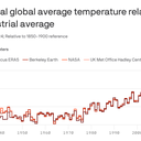
Data: Copernicus; Chart: Danielle Alberti/Axios

Last year was Earth's warmest on record, eclipsing 2023's record and for the first time exceeding the Paris target of 1.5ยฐC above preindustrial levels, the Copernicus Climate Change Service announced.

Why it matters: While climate scientists don't put too much stock into an individual year's record, the long-term trend is toward more rapid warming, and it is not entirely clear why 2024 was so hot and what it portends.


Map showing surface air temperature anomalies in 2024 compared to 1991-2020 average. Image: Copernicus Climate Change Service

Zoom in: Last year was the hottest seen in instrument record-keeping but also much longer before that.

  • In fact, as with 2023, the year was very likely the hottest in at least 125,000 years.
  • Some daily global average temperatures, as measured using increasingly precise computer model data, exceeded 2ยฐC above preindustrial levels โ€” flirting with another temperature target in the Paris climate agreement.

According to Copernicus, an agency of the European Commission, each year in the last decade has been one of the 10 hottest on record.

  • Global average surface temperatures in 2024 were about 1.6ยฐC above pre-industrial levels, Copernicus found, and about 0.12ยฐC (.22ยฐF) above 2023's record high.
  • Data from U.S. centers, such as NOAA and NASA, show similar results. The World Meteorological Organization, a U.N. agency, also found that the global average surface temperature in 2024 exceeded 1.5ยฐC above preindustrial levels.
  • Berkeley Earth, an independent temperature monitoring group that also released its 2024 data Friday, noted in a report that the record-breaking warmth of the past two years "demonstrates a clear deviation from the long-term warming trend, suggesting that warming rates have increased, at least in the short term."

Yes, but: The Paris Agreement's most stringent temperature target of holding warming to 1.5ยฐC compared with pre-industrial levels refers to a long-term, 20-to-30-year average, rather than a single year or two.

  • Still, 2024 shows the world is already exceeding the barrier that diplomats set at the Paris climate summit in 2015, and in fact the average of 2023 and 2024 falls above the 1.5ยฐC threshold, Copernicus said.
  • Studies show that if warming exceeds 1.5ยฐC relative to preindustrial levels, the odds of potentially catastrophic impacts, such as the shutting of key ocean currents and melting of Arctic and Antarctic ice sheets, would increase considerably.
  • Regarding exceeding the 1.5ยฐC marker, Copernicus' news release stated: "Global temperatures are rising beyond what modern humans have ever experienced."

Reality check: While global leaders are still committed to the 1.5-degree goal, it is partly because of a lack of consensus of what a new target should be.

  • Most climate scientists don't think the current threshold is feasible.
  • Berkeley Earth bluntly states as much in its report: "The Paris Agreement goal of limiting warming to 1.5ยฐC will not be met, and the long-term average referenced by this target will exceed this threshold in the next five-to-10 years, conservatively."

What they're saying: "Humanity is in charge of its own destiny but how we respond to the climate challenge should be based on evidence," Carlo Buontempo, the Copernicus Climate Change Service's director, said in a statement.

  • "Whether it is at a level below or above 1.5ยฐC of warming, every additional increment of global warming increases the impacts on our lives, economies and our planet," said WMO Secretary-General Celeste Saulo in a separate statement.

Between the lines: One of the most impactful records seen during 2024 was unusually high amounts of water vapor in the atmosphere, at about 5% above the 1991-2020 average, beating previous highs.

  • Extreme heat and high humidity is a deadly combination, and record large swaths of the globe saw "strong" to "extreme heat stress," per Copernicus' data.
  • The high water vapor content in the atmosphere also helped contribute to extreme precipitation events and to rapidly intensifying tropical cyclones such as hurricanes Helene and Milton.

The intrigue: Climate scientists are still investigating why 2024, which didn't feature 2023's planet-warming El Niรฑo event on top of human-caused climate change, vaulted above the previous year on the list of hottest years.

What's next: Along with NOAA's and NASA's climate reports on Friday will come a new report on trends in ocean heat content.

  • All of it is likely to show evidence of a planet heating faster and to record levels.

Editor's note: This story has been updated with additional details and comments from WMO Secretary-General Celeste Saulo.

2024: Earth's hottest year and first to exceed Paris target

9 January 2025 at 19:00
Data: Copernicus; Chart: Danielle Alberti/Axios

Last year was Earth's warmest on record, eclipsing 2023's record and for the first time exceeding the Paris target of 1.5ยฐC above preindustrial levels, the Copernicus Climate Change Service announced Thursday.

Why it matters: While climate scientists don't put too much stock into an individual year's record, the long-term trend is toward more rapid warming, and it is not entirely clear why 2024 was so hot โ€” and what it portends.


Map showing surface air temperature anomalies in 2024 compared to 1991-2020 average. Image: Copernicus Climate Change Service.

Zoom in: Last year was the hottest seen in instrument record-keeping, but also much longer before that.

  • In fact, as with 2023, the year was very likely the hottest in at least 125,000 years.
  • Some daily global average temperatures, as measured using increasingly precise computer model data, exceeded 2ยฐC above preindustrial levels โ€” flirting with another temperature target in the Paris Climate Agreement.

According to Copernicus, an agency of the European Commission, each year in the last decade has been one of the 10 hottest on record.

  • Data from U.S. centers, such as NOAA and NASA, show similar results. (Their final 2024 data comes out Friday.)
  • Global average surface temperatures in 2024 were about 1.6ยฐC above pre-industrial levels, Copernicus found, and about 0.12ยฐC (.22ยฐF) above 2023's record high.

Yes, but: The Paris Agreement's most stringent temperature target of holding warming to 1.5ยฐC compared with pre-industrial levels refers to a long-term, 20-to-30-year average, rather than a single year or two.

  • Still, 2024 shows the world is already exceeding the barrier that diplomats set at the Paris climate summit in 2015, and in fact the average of 2023 and 2024 falls above the 1.5ยฐC threshold, Copernicus said.
  • Studies show that if warming exceeds 1.5ยฐC relative to preindustrial levels, the odds of potentially catastrophic impacts, such as the shutting of key ocean currents and melting of Arctic and Antarctic ice sheets, would increase considerably.
  • Regarding exceeding the 1.5ยฐC marker, Copernicus' news release stated: "Global temperatures are rising beyond what modern humans have ever experienced."

What they're saying: "Humanity is in charge of its own destiny but how we respond to the climate challenge should be based on evidence," said Carlo Buontempo, the Copernicus Climate Change Service's director.

  • "The future is in our hands โ€” swift and decisive action can still alter the trajectory of our future climate."

Between the lines: One of the most impactful records seen during 2024 was unusually high amounts of water vapor in the atmosphere, at about 5% above the 1991-2020 average, beating previous highs.

  • Extreme heat and high humidity is a deadly combination, and record large swaths of the globe saw "strong" to "extreme heat stress," per Copernicus' data.
  • The high water vapor content in the atmosphere also helped contribute to extreme precipitation events, and to rapidly intensifying tropical cyclones, such as hurricanes Helene and Milton.

The intrigue: Climate scientists are still investigating why 2024, which didn't feature a planet-warming El Niรฑo event on top of human-caused climate change, vaulted above 2023 on the list of hottest years.

What's next: Along with NOAA's and NASA's climate reports on Friday will come a new report on trends in ocean heat content.

  • All of it is likely to show evidence of a planet heating faster and to record levels.

More LA fire threats loom into Friday, NWS warns

9 January 2025 at 14:11

As wildfires incited by high winds and record dry conditions ravage Los Angeles County, the National Weather Service is warning of continued high-risk weather to come both this week and next.

The big picture: Winds will once again pick up Thursday evening into Friday morning across the Los Angeles region, with damaging gusts in the foothills and the potential for additional fire spread, NWS forecasters said Thursday afternoon.


  • Forecasts call for wind gusts up to 55 mph overnight Thursday into Friday, and more high-wind threats are looming for LA County into early next week.
Computer model projections for median surface winds for Southern California on Jan. 14. Photo: Pivotal Weather

What they're saying: "Gusty Santa Ana winds will continue across the Southland into Friday, strengthening again tonight through Friday morning," NWS Los Angeles forecasters said in an online discussion.

  • "Another round of gusty north to northeast winds will develop between Saturday and Sunday, then a stronger offshore wind event is possible between Monday night and Tuesday."
Forecast precipitation from the Weather Prediction Center for the lower 48 states, showing no precipitation likely for California through Tuesday. Photo: Pivotal Weather

Threat level: The Santa Ana wind event early next week looks particularly threatening due to a continued lack of rainfall, with computer model projections predicting that winds could reach well above 50mph.

  • "There is concern that fire weather conditions could become exacerbated given the antecedent conditions, little rain across the area since the Spring of 2024, and another offshore wind event on top of all of what we have seen, so far," NWS forecasters wrote.
  • "Residents are urged to stay tuned to latest information and remain vigilant in steps to protect your life and property."

Catch up quick: The Los Angeles County fires have burned at least 25,000 acres, been the cause of five confirmed deaths and placed almost 180,000 residents under evacuation orders.

  • Los Angeles Unified schools and offices will remain closed on Friday, with almost two dozen school districts also planning full or partial closures.

More from Axios:

LA's wildfires sparked by rare collision of climate factors

8 January 2025 at 05:49

At least three destructive, fast-moving wildfires were burning in the Los Angeles metro area early Wednesday.

  • Tens of thousands of people evacuated, some having run on foot to flee oncoming flames.

The big picture: The wildfires are the result of an unheard-of combination of factors at this time of year โ€” the worst high wind event in Southern California since 2011, plus some of the driest conditions on record for early January.

  • Downtown LA has received just 0.16 inches of rain since May 6 of last year, making it the second-driest period on record for May 6 to Dec 31, according to the National Weather Service.
  • January is typically during the region's wet season.
  • Bone-dry conditions in Southern California contrast with the northern parts of the state, where atmospheric rivers have squelched fire risks.
  • Even worse, the region had an unusually hot summer that dried out vegetation even further.

Threat level: Warnings for "particularly dangerous situation" red flag fire weather conditions and "extremely critical" risk continue across Southern California through late Wednesday as at least four significant fires burn in the LA metro area.

  • Whipped by powerful Santa Ana winds gusting up to 99 mph, particularly in hilly terrain, the fires forced chaotic evacuations in parts of the area, particularly related to the Palisades Fire.
  • High winds are affecting the wildfires, with gusts of 50 to 70 mph and higher in some lower elevations. Burbank Airport, for example, gusted to 84 mph.
  • Near the Palisades Fire, winds have reached 98 mph, with 90 mph winds not far from the Eaton Fire near Altadena, Calif.
  • UCLA climate scientist Daniel Swain referred to the high winds as an "atmospheric blow dryer" for its effects on trees and other vegetation.

Context: Climate change is intensifying hydroclimate extremes, both wet and dry, including weather whiplash events where California see-saws between the two.

  • With dry conditions lasting later into the fall, that means Southern California is more vulnerable to dry high wind events, Swain noted.
  • "Climate change is increasing the overlap between extremely dry vegetation conditions later in the season and the occurrence of these wind events," he said in an online briefing.

What they're saying: Alex Hall, also with UCLA, said the hydroclimate situation plus the strong winds have suddenly created a precarious situation.

  • "Southern California has experienced a particularly hot summer, followed by almost no precipitation during what is normally our wet season," he said.
  • "And all of this comes on the heels of two very rainy years, which means there is plenty of fuel for potential wildfires."

What's next: More wind-driven wildfires may yet erupt before this event is over.

Go deeper: Wind-driven fires in Los Angeles area engulf homes, force evacuations

Wildfires erupt in L.A. as "life-threatening" Santa Ana winds hit Southern California

8 January 2025 at 01:12

Los Angeles County saw multiple wildfires erupt as "extremely critical fire weather" from dry conditions and Santa Ana winds threatened Southern California into Wednesday, and the National Weather Service warned the worst was yet to come.

State of Play: The biggest blaze was the uncontained Palisades Fire. It triggered mandatory evacuations for at least 30,000 people in the Pacific Palisades area as it threatened multiple structures across at least 2,921-acres between Malibu and Santa Monica, where evacuation orders were issued Tuesday evening.


  • More evacuation orders were issued as more fires erupted in L.A. County as the onslaught of the strongest Santa Ana winds arrived Tuesday.
  • Other notable wildfires included the Eaton Fire near Pasadena, where evacuation orders were in effect as the blaze swelled to 1,000 acres at 0% containment in the Eaton Canyon area as of early Wednesday.
  • Sylmar residents were evacuated from the Hurst Fire late Tuesday after the blaze ignited near where Interstate 5 and the 14 and 210 freeways meet about 10:29pm local time. It had grown to 100 acres as of 12:36am.

Threat level: Rare, late-season, "Particularly Dangerous Situation" red flag warnings are in effect as the region faces a life-threatening, destructive and widespread windstorm after months of dry weather that could produce hurricane-force gusts of up to 100 mph in some areas, per an advisory from the NWS' Los Angeles/Oxnard office.

  • The NWS said on X an "extremely dangerous situation is unfolding in southern California tonight." The forecast was for widespread "DAMAGING WIND and EXTREME FIRE WEATHER for most of Los Angeles/Ventura Counties," the NWS said.
  • "Time period of greatest concern: Tonight-Wednesday afternoon," it added. "Widespread N/NE gusts 50-80 mph, Isolated 80-100 mph mountains/foothills with scattered downed trees and power outages likely."
  • University of California, Los Angeles, climate scientist Daniel Swain said on Bluesky that the situation was the worst since a destructive event in 2011 that saw fires in Pasadena and the surrounding areas.
  • There's a "much greater wildfire risk" this time "due to far drier vegetation," Swain said.

In another sign of the seriousness of the situation, the Storm Prediction Center designated parts of the L.A. area as being in its highest risk category of "extremely critical" for Wednesday and Thursday.

NWS Incident Meteorologists (IMET) Operations/X

By the numbers: The NWS' Los Angeles office has already recorded wind gusts at or exceeding 70 mph.

  • These include Deer Creek Canyon (80 mph), Boney Mountain (76 mph), Corral Canyon Park (75 mph), Sandstone Peak (73 mph), Castro Peak (71 mph) and Rancho De Cielo (70 mph).

The big picture: President Biden said in a Tuesday night statement that he was being "frequently briefed on the wildfires in west Los Angeles" and his administration "will do everything it can to support the response."

  • California Gov. Gavin Newsom proclaimed a state of emergency in response to the Palisades Fire on Tuesday. He and Cal Fire deployed resources to SoCal areas expected to be impacted by this windstorm and extreme fire risk due to high winds and low humidity, per Monday evening statements.
  • Southern California Edison spokesperson Jeff Monford said in a Monday evening phone interview the utility had notified 411,000 customers that a public safety power shutoff could affect them on Tuesday and Wednesday.
  • The utility's power safety shutoffs affected 22,236 customers in Los Angeles County and another 2,968 in Ventura County as of 7:30pm local time amid powerful winds, per the company's outage tracker.
  • Monford said the issue was "not that the grid is vulnerable to wind," it's that objects could potentially become airborne and hit a power line and "cause a spark and because the vegetation on the ground an is so dry, that could be hazardous."

Context: Swain in a video briefing on Monday afternoon said parts of SoCal were "going on nine or 10 months now without meaningful rain. ... it's been the driest start to the season on record in some parts of Southern California, also the driest nine-month period on record in some of those same places."

Between the lines: Evidence suggests climate change is "increasing the overlap between extremely dry vegetation conditions later in the season and the occurrence of these wind events," said Swain during his briefing.

  • That's because "if we'd gotten three or four inches of rain" before this event, "we wouldn't really be talking about the wildfire risk, about the wind damage potential."
  • There's evidence that climate change "has already affected and will continue to accentuate changes in seasonal hydro climate, but not so much evidence, it's really affecting the winds themselves, or that it will necessarily in the future," Swain added.

What to expect: The strongest winds with gusts of 50 to 80 mph were expected into early Wednesday afternoon.

  • Red flag warnings were coming into effect elsewhere in California on Wednesday, including in San Diego County from the morning through 6pm.
  • Areas impacted by red flag warnings will face increased risks of extreme fire behavior and large fires with "VERY RAPID" spread, the NWS said.

Go deeper: Extreme wildfires doubled in frequency, magnitude since 2003

Editor's note: This article has been updated with new details throughout.

Deadly L.A. County fires destroy thousands of structures

Raging wildfires tearing through Los Angeles County into Thursday have razed neighborhoods across the area, leaving behind a trail of destruction and deaths.

The latest: At least 10 fire-related deaths have been reported as of 9pm local time, per a statement from the County of Los Angeles Department of Medical Examiner.


  • At least two of the deaths occurred in the Palisades Fire and at least three were confirmed in the Eaton Fire, officials said at a briefing earlier Thursday.

State of play: Extra federal and state resources have been deployed to the region, but powerful Santa Ana winds driving fires in extremely dry vegetation have made conditions challenging for firefighters.

  • The Palisades Fire is California's third-most destructive fire on record, burning an estimated 5,316 structures. Cal Fire lists the Eaton Fire as the fourth-most destructive, in terms of structures destroyed, with 5,000-plus structures believed to have been razed.
  • The wildfires have caused "significant damage" to L.A. County's sewer, power and transportation systems, L.A. County Public Works director Mark Pestrella said at the briefing, adding that debris from the fires could be hazardous or even toxic.
  • Images shared online showed flames engulfing multiple homes and residents abandoning their cars in Pacific Palisades, including the Palisades Charter High School and the Getty Villa museum.

Zoom in: The destruction across the greater L.A. area is so vast that parts "look like a bomb was dropped" on them, L.A. Sheriff Robert Luna said at a Thursday briefing.

  • President Biden said Thursday the federal government will cover 100% of California's disaster assistance costs for the wildfires. The funding will support debris and hazardous materials removal, first responders' pay and temporary shelters.
  • Luna added that nearly 180,000 county residents were under evacuation orders.
  • All Los Angeles Unified Schools and offices remained closed on Friday. Almost two dozen school districts have planned full or partial closures, per LAist.

Threat level: The National Weather Service's L.A. office expected the strong winds that have driven the fires that picked back up on Thursday afternoon to continue into Friday.

Situation report: Firefighters made progress with the Palisades Fire, between Malibu and Santa Monica, reaching 6% containment as it burned over 19,978 acres as of 11:19pm local time.

  • The Eaton Fire remained 0% contained over 13,690 acres. However, a brief drop in winds helped firefighters curb the spread of the Eaton Fire and "growth has been significantly stopped," L.A. County Fire Chief Anthony Marrone said.

Meanwhile, L.A. Mayor Karen Bass confirmed on X Thursday that the Sunset Fire in Hollywood Hills was "fully contained" over 43 acres Thursday morning.

  • L.A. County firefighters made progress with the Lidia Fire that's burned 348 acres in a rural, mountainous area near Acton. It was 60% contained as of Thursday evening.
  • The Hurst Fire that's burned 771 acres in the San Fernando Valley, some 25 miles northwest of downtown L.A., was 37% contained.

Driving the news: The wildfires ignited after months of dry weather. Many areas have been hit by hurricane-force gusts of 74 mph or higher. Magic Mountain Truck Trail, east of Santa Clarita, recorded a gust at 90 mph.

  • The NWS' L.A. office said on X peak winds increased again across the region on Thursday and reached 74 mph along the trail that day.
  • Millions of people in Southern California were affected by rare, late-season red flag warnings due to "widespread damaging north to northeast winds and extreme fire weather conditions," per a forecast discussion from the National Weather Service's Los Angeles office.

By the numbers: More than 120,000 customers in Los Angeles and Ventura counties were without power early Friday, according to PowerOutage.us.

Between the lines: Many parts of Southern California have not seen any meaningful rainfall for more than eight months.

In photos: Palisades Fire engulfs L.A. homes

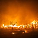
Firefighters battle winds and flames as multiple beachfront homes go up in flames along Pacific Coast Highway in Malibu in the Palisades Fire on Jan. 7. Photo: David Crane/MediaNews Group/Los Angeles Daily News via Getty Images
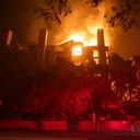
The Getty Villa art museum is threatened by the Palisades Fire's flames on Jan. 7. Photo: David Swanson/AFP via Getty Images
Three men watch as a house is engulfed in flames from the Palisades Fire on Jan. 7. Photo: Robyn Beck/AFP via Getty Images
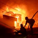
A firefighter walks down a driveway to a home engulfed in fire in Pacific Palisades on Jan. 7. Photo: Hans Gutknecht/MediaNews Group/ Los Angeles Daily News via Getty Images
The Palisades Fire burns near homes in Pacific Palisades on Jan. 7. Photo: David Swanson/AFP via Getty Images
A firefighter in Pacific Palisades tackles the wildfire that was pushed by gusting Santa Ana winds on Jan. 7. Photo: Qian Weizhong/VCG via Getty Images
Plumes of smoke from the Palisades Fire in Pacific Palisades on Jan. 7. Photo: David Swanson/AFP via Getty Images
People evacuate their home in Pacific Palisades due to the wildfire on Jan. 7. Photo: David Swanson/AFP via Getty Images
Smoke rises from a burning vehicle during the Palisades Fire on Jan. 7 in Pacific Palisades, Los Angeles. Photo: Qian Weizhong/VCG via Getty Images

Go deeper:

Editor's note: This article has been updated with new details throughout. A prior version had a correction on the rise of the death toll.

Axios' April Rubin contributed reporting.

Biden issues sweeping offshore oil and gas drilling ban, could slow Trump's priorities

6 January 2025 at 02:00

President Biden is moving to block about 625 million acres of offshore areas from future oil and gas drilling, the White House announced Monday morning.

Why it matters: The sweeping actions โ€” which drew strong criticism from the oil industry โ€” may hinder President-elect Trump's ability to quickly deliver on plans to scale up fossil fuel production.


  • The steps rely on a provision from a 72-year-old law and affect wildlife-rich areas in the northern Bering Sea; the eastern Pacific Ocean off the West Coast; the eastern Gulf of Mexico; and areas up and down the East Coast.

Driving the news: The steps, in the form of two presidential memos, are designed to permanently protect vast tracts of offshore lands to potentially benefit states dependent on fisheries and tourism.

  • Withdrawing hundreds of millions of acres โ€” equivalent in size to the states of Alaska, California and Colorado โ€” from potential leasing may also help limit greenhouse gas emissions that are causing global warming.

Unlike executive orders that Trump could overturn with the stroke of a pen, Biden's actions rely on an open-ended provision in the 1953 Outer Continental Shelf Lands Act.

  • This law governs energy leasing activities for submerged lands under U.S. control that are beyond three miles from shore.
  • A provision in the act allows the president to permanently take parts of the Outer Continental Shelf off the table for leasing activities, without providing a means for another president to undo the action.

What they're saying: "Congress and the incoming administration should fully leverage the nation's vast offshore resources as a critical source of affordable energy, government revenue and stability around the world," American Petroleum Institute President Mike Sommers said in a statement.

  • "We urge policymakers to use every tool at their disposal to reverse this politically motivated decision and restore a pro-American energy approach to federal leasing."

Between the lines: Kevin Book of research firm ClearView Energy Partners told Axios in an email that congressional Republicans could include a provision reinstating some or all of the offshore areas in any filibuster-proof budget reconciliation bills.

The big picture: Biden is portraying the steps as part of his environmental legacy, which has included major climate legislation and land conservation efforts.

  • "As the climate crisis continues to threaten communities across the country and we are transitioning to a clean energy economy, now is the time to protect these coasts for our children and grandchildren," Biden said in a statement.

Yes, but: Many of the regions to be protected are locations that the oil and gas industry had not shown strong interest in for development. Other protections would apply to places where states put up stiff resistance against drilling.

  • This applies particularly to California and Florida, both of which have consistently opposed offshore drilling.
  • During Trump's first term, he exempted a region from North Carolina to Florida from drilling for 10 years, given political opposition to such activities in these coastal states.
  • The industry has largely backed off from expensive forays into Arctic drilling, including the Bering Sea where there are no active or pending lease sales.
  • However, human-caused Arctic climate change is making the region far more accessible for development and shipping routes and could entice companies to explore for fossil fuel resources in coming years.

Friction point: Oil and gas companies have shown interest in drilling in the eastern Gulf of Mexico, where significant resources are thought to be accessible.

  • That makes the designation of this region as off limits to be particularly notable and potentially controversial, even with Florida's opposition to offshore drilling for environmental reasons.
  • The use of the law, which grants the president broad power to alter the regions subject to oil and gas leasing, is likely to be tested in court.
  • One district court ruling from 2019, which involved a step taken during the Obama administration, held that only Congress could overturn a president's use of the provision within the law.

The bottom line: While Trump can still move forward with plans to boost land-based oil and gas production, he will now face new legal hurdles on offshore drilling.

"Major" winter storm to usher in severe Arctic outbreak across U.S.

5 January 2025 at 21:29

A high-impact winter storm is bringing more than a foot of snow, hazardous ice and severe weather Sunday through Tuesday to tens of millions of people, many of whom are unaccustomed to such conditions.

Threat level: In Kansas City, heavy snow fell throughout Sunday, following a skating rink of ice on Saturday. In the South, severe thunderstorms prompted tornado warnings. All of this inclement weather is headed for the Mid-Atlantic region, where D.C. schools closed in anticipation of up to a foot of snow.


  • An Arctic outbreak partially tied to the polar vortex encircling the far north was moving into parts of the U.S. on Sunday night. It's set to bring some of the coldest air in years to locations east of the Rocky Mountains during the next two to three weeks.

By the numbers: More than 110 million people, roughly a third of the U.S. population, were under some type of precipitation-related winter storm alert early Monday, according to the National Weather Service. This includes everything from a blizzard to ice storm warnings.

  • An estimated 61,000 customers were without power in Kentucky, as were over 47,000 in Indiana and nearly 35,000 in Missouri โ€” mostly due to ice early Monday.
  • In Illinois, the state emergency management agency said on X just before midnight that about 36,000 customers were without electricity in the state's south amid "many reports of downed trees and tree branches" after freezing rain and sleet "burdened trees with extra weight."
  • More than half the U.S. population is expected to see temperatures drop to 32ยฐF or below during the next seven days โ€” with many seeing far colder temperatures.

The big picture: The storm will help pull more bitterly cold Arctic air southward on its heels, as blustery winds kick in from the northwest. Most of the U.S. will see temperatures dip down to the freezing mark.

  • With temperature anomalies of 15ยฐF to 25ยฐF below average for this time of year, the cold will be noteworthy more for its duration than its intensity, however.
  • The Electric Reliability Council of Texas (ERCOT) on Sunday issued a Weather Watch from Jan. 6-10 due to forecast cold weather. Texas' grid has been vulnerable to winter and summer weather extremes, though solar power helped keep supply stable during an Arctic blast last year.
  • Computer models are hinting that another major storm, perhaps followed by even more intense cold, could occur late in the coming week.
  • Since January is typically the coldest time of year, any negative temperature departures from average can result in significant cold.

Where it is snowing and how much will fall

Zoom in: The National Weather Service is warning of "major" winter storm impacts across central and northern Kansas, into Kansas City, where more than a foot of snow and sleet could fall this weekend.

  • The NWS issued a rare blizzard warning for central and eastern Kansas and parts of Missouri, including areas near Kansas City, as strong winds and heavy snow reduced visibility to near zero.
  • Unusually heavy snow will also accumulate near St. Louis, where "major" storm impacts are likely, according to NOAA's Winter Storm Severity Index.
  • For these regions, "This could be the heaviest snowfall in over a decade," the NWS stated via a post on X. The agency warned of "dangerous to impossible driving conditions" along with "considerable disruption to daily life."
  • Another area of major winter storm impacts is forecast for the Mid-Atlantic, specifically the Washington metro area, where 6 to 12 inches of snow could fall between Sunday night and early Tuesday morning.

If these amounts verify, it would be the biggest snowstorm in these areas since at least 2022, and could eclipse snow totals from some entire winter seasons in recent years.

Map of winter storm-related warnings and watches across the Lower 48 states on Jan. 5. Credit: Pivotal Weather

Between the lines: Perhaps the most impactful winter storm-related threat is freezing rain.

  • To the south of the extensive snow shield, a strip of damaging ice will build up on trees and power lines, potentially knocking out electricity to millions of people from central Kansas to West Virginia Sunday into Monday.
  • "Dangerous travel conditions, widespread tree damage, and prolonged power outages are expected along this corridor," the NWS stated in an online discussion.
  • Such outages could last many days, particularly because of the lack of experience with such hazards in this region.

The intrigue: After this storm exits into the Atlantic on Tuesday, forecasters will be eyeing both a lobe, or piece, of the polar vortex swirling over Canada, which could be directed southward into the U.S. in about a week, or remain trapped in Canada.

  • Also facing scrutiny will be the potential for any other major winter storms given the cold air entrenched across the U.S.

Fun fact: The annual meeting of meteorologists from around the U.S. and abroad takes place next week, and is infamous for prompting its own extreme weather.

Go deeper: In photos: Major winter storm blasts much of the U.S.

Editor's note: This article has been updated with new details throughout.

Arctic blast to accompany major winter storm, send temperatures plunging for 230 million

3 January 2025 at 02:50

The much-advertised, long-lasting Arctic outbreak with ties to the polar vortex will be accompanied by a significant winter storm over the weekend.

Threat level: The storm is set to deliver upwards of a foot of snow in parts of the Plains, Midwest and Appalachians, with somewhat lower amounts for Washington, D.C., Baltimore and potentially Philadelphia as well.


  • Multiple states are forecast to see a destructive ice storm that could lead to widespread, enduring power outages. The ice zone will stretch from parts of Nebraska eastward to Kentucky and West Virginia.
  • "Treacherous travel conditions are expected with power outages likely in areas that receive over a quarter-inch of ice accumulation," the National Weather Service said via X on Thursday evening.

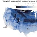
By the numbers: As the storm exits late this weekend into early next week, Arctic air will be drawn southward out of Canada, sending temperatures plunging below 0ยฐF, across the northern Plains and Upper Midwest.

  • Temperatures may drop below freezing overnight as far south as the Gulf Coast next week.
  • Fresh snow and ice cover will exacerbate the cold by efficiently radiating heat back into space overnight, and reflecting incoming solar energy during the day.
  • During the next seven days โ€” week one of an enduring cold snap that could stretch through Inauguration Day โ€” 234 million people in at least 40 states could see temperatures at or below 32ยฐF, according to WeatherBell Analytics.
  • Some cities, including Washington, may not see high temperatures rise much above the mid-30s for several days in a row.

Between the lines: For most, the cold will be noteworthy for its duration rather than its severity, as computer models have backed off from earlier projections of historically low temperatures.

  • For many U.S. residents, this event will bring the coldest air in several years, following a few unusually mild winters.

Context: This Arctic outbreak is tied in part to a stretching of the polar vortex, which is an area of low pressure in the upper atmosphere, and the air circulation around it, that forms each winter in the Northern Hemisphere.

  • Other weather features, such as a strong high pressure area off the West Coast and Alaska, and another so-called "Blocking High" over Greenland, have opened the Arctic's refrigerator door.
  • Some scientists have published studies linking rapid, human-caused Arctic climate change with shifts in the polar vortex, though this is part of an active debate.

Zoom out: The colder than average start to January across much of the U.S. is causing natural gas prices to spike.

Polar vortex-related Arctic outbreak to put U.S., Europe in deep freeze

2 January 2025 at 05:40

An Arctic outbreak featuring punishing cold weather is beginning across much of the U.S. at the same time that Europe prepares for plunging temperatures.

Why it matters: About three weeks of cold east of the Rocky Mountains โ€” potentially accompanied by major winter storms โ€” will boost natural gas prices, pose a risk of power outages and disrupt travel.


Threat level: The cold will hit the U.S. in waves, with the first moving in this week, a second early next week on the heels of a significant Plains to Mid-Atlantic winter storm, and additional ones after that.

  • Each push is likely to be colder than the one preceding it.
  • By early next week, daily high temperatures may be stuck in the single digits across parts of the Midwest, with the possibility of temperatures dropping to 32ยฐF all the way to the Gulf Coast.
  • In the East, highs in Washington, D.C., may not get much above freezing for several days in a row during the Jan. 4-10 period, with the possibility of even colder weather arriving after that.
  • Before this event ends, residents of at least 30 states will have been affected. Millions will see increased heating bills as natural gas prices spike, and some could be affected by rolling blackouts during the coldest periods.

Zoom in: The polar vortex is an area of low pressure that exists over the Arctic at the upper levels of the atmosphere, in the stratosphere, during winter.

  • Strong winds circulate counterclockwise around this low pressure area, and build up and trap some of the coldest air in the Northern Hemisphere across the Arctic.
  • When these strong winds slacken, parts of the polar vortex can detach and meander southward, bringing ultra-cold air to southern Canada, the U.S. and Europe.
  • This occurred back in the winter of 2013-14, but this new event is distinct.
  • Instead, the stratospheric polar vortex is becoming "stretched" from north to south across the North Pole.

Between the lines: The stretched vortex may be setting in motion a complicated board of atmospheric chess pieces that include a strong area of high pressure over Greenland.

  • That stops storms from heading out to sea and directs cold weather in the eastern United States.
  • This setup, known as a Greenland Block, along with other, broader patterns of air pressure over the Arctic and North Atlantic, also tends to favor unusually cold conditions in northern Europe.
  • The Greenland Block is combining with a high pressure area stretching from California to Alaska to promote air to flow from Siberia, across the pole, and southward toward the continental U.S.

This cross-polar air flow can translate to temperatures of about 20ยฐF to 30ยฐF below average for this time of year.

What they're saying: "It is the stretching of the polar vortex that allows colder temperatures normally confined to the Arctic to spread much further south of normal," said Judah Cohen, a meteorologist at AER who researches Arctic climate change and the polar vortex, via email.

Zoom out: Uncertainty remains about how cold the U.S. will get, along with the timing and occurrence of any major storms beyond the first one this weekend.

  • Some computer models have backed off initial predictions of truly historic cold that would rival outbreaks dating back several years, if not longer.
  • The possibility still exists of a lobe, or piece, of the tropospheric polar vortex diving south from Canada and into the South and Southeast, sending temperatures plunging well below the levels currently forecast.
  • This would lead to extremely cold conditions, most likely during the Jan. 9-Jan. 14 time frame.
  • In such a scenario, some state power grids could struggle to keep up with demand as power plants deal with cold weather-induced reductions in generation, as occurred in Texas in 2021.

Context: Studies suggest polar vortex shifts may be more likely due to human-caused climate change, but this is an area of active research.

Friction point: But scientists are somewhat at odds over the extent to which shifts in the orientation of the polar vortex are driving this particular cold snap.

  • Cohen points to the stretching polar vortex and long-term climate change as significant players.
  • But Amy Butler, an atmospheric scientist at NOAA's Chemical Sciences Laboratory, told Axios she sees other factors as more significant drivers right now.
  • "In this case, I'm not convinced that the polar vortex stretching is driving the cold," Butler told Axios via email.
  • "To me, it seems more likely that the persistent blocking high over Greenland over the next few weeks, along with a building ridge off the coast of California, are working in concert to drive cold into the eastern US for an extended period of time," she said.

The bottom line: Regardless of the causal chain, extreme cold is on the way for more than 150 million Americans.

Polar vortex-related frigid air, snowstorms likely to grip U.S. to start 2025

31 December 2024 at 08:46

Areas of the U.S., including the South and Southeast, are likely to see frigid air that could break records by mid-month, along with potentially blockbuster winter storms.

Threat level: Pieces of the polar vortex are projected to swirl southward out of northern Canada and into parts of the U.S. during early and mid-January.


  • Accompanying the cold will be the threat of multiple significant winter storms.
  • The weather pattern features a strong high pressure area over Greenland and a deep dip, or trough, in the jet stream across the East.
  • This setup uniquely favorable for producing potentially significant snowstorms for the Southeast, Mid-Atlantic or Northeast.

Between the lines: The cold itself could present infrastructure challenges, depending on where the most frigid air sets up.

  • The most extreme scenarios may pose risks of power outages in some states, but there is still considerable uncertainty about the magnitude of the cold and hardest hit areas.
  • There are some broad outlines that are known this far out, however. Computer models have been signaling for days that the South, including areas from Texas to Alabama, as well as Southeast and Appalachians may see the brunt of the coldest air.

Overnight low temperatures below 0ยฐF are possible in these areas during the coldest periods.

When the coldest weather may hit

The big picture: At least two rounds of extreme cold and storm threats are slated for the Midwest and Eastern U.S.

  • The first should take place soon after New Year's, though this storm may produce a wintry mix rather than mainly snow across New England.
  • Next up is the time period that meteorologists are eyeing closely for potentially significant East Coast winter storms, between about Jan. 6 through the 14th.
  • Even without a storm or two, extreme cold will be on the move, crossing the U.S.-Canadian border and diving all the way to the Gulf Coast.
  • The coldest air of the season so far and dangerous wind chills are expected across much of the Southeast from Jan. 7-13.

"Below freezing temperatures are possible as far south as the Gulf Coast and much of the Florida Peninsula," the National Weather Service's Climate Prediction Center warns. "Impacts to highly sensitive citrus crops are possible."

  • Modeling and NOAA projections show that if the cold were to reach its full potential, temperatures may plunge to 25ยฐF to 35ยฐF degrees below average for this time of year during mid-January.

pic.twitter.com/TmeiACrRC0

โ€” NWS Climate Prediction Center (@NWSCPC) December 30, 2024

Zoom in: The polar vortex is an area of low pressure that exists over the Arctic at the upper levels of the atmosphere, in the stratosphere, during wintertime.

  • Strong winds circulate counterclockwise around this low pressure area, and build up and trap some of the coldest air in the Northern Hemisphere across the Arctic.

Yes, but: When these strong winds slacken, parts of the polar vortex can detach and meander southward, bringing ultra-cold air to southern Canada, the U.S. and Europe.

  • This most famously occurred during the winter of 2013-2014, and some computer models show this is likely to happen again in mid-January, with a piece of the polar vortex sliding from Minnesota to the Southeast.
  • During this event, the stratospheric polar vortex is forecast to be "stretched" from north-to-south across the North Pole, rather than oriented as a tight circle.
  • This could favor unusually cold weather and winter storms in the East, but it is not a classic setup for the coldest-possible event, according to meteorologist Judah Cohen of AER, a Verisk company.

Context: Numerous studies suggest polar vortex excursions may become more likely in a warming world, but this is still an area of active research.

  • One such study, published in the journal Environmental Research: Climate, on Dec. 11, found that as global average temperatures continue to increase, due mainly to human emissions of greenhouse gases, cold air outbreaks in the midlatitudes could become more frequent.
  • This study is unique since it puts forward a hypothesis of how such extreme cold events are becoming more likely, rather than just finding statistical correlations.

The bottom line: Extreme cold and snowstorms, capable of producing billions in economic impacts, are on the way for much of the U.S..

Editor's note: This article was corrected to show that, in the northern hemisphere, winds circulate counterclockwise (not clockwise) around low pressure areas.

Tornado outbreak targets the South as winter storm forms

28 December 2024 at 13:47

A severe weather outbreak, including long-lasting and intense tornadoes, is affecting a swath of the South on Saturday into Saturday night.

Threat level: The Storm Prediction Center has issued a rare "moderate risk" outlook, or level 4 out of 5 on the threat scale, for portions of Mississippi and Louisiana, indicating confidence in a potentially significant outbreak.


  • Already, long-lasting, damaging tornadoes have struck southeastern Texas, including coastal sections of Harris County and near Port Arthur.
  • Some of these circulations have persisted for more than 60 miles, with tornadoes on the ground for a significant portion of that distance.
  • The text of the tornado warnings has included enhanced language, indicative of the threat level involved: "This is a particularly dangerous situation! Take Cover Now!" the NWS forecast office in Lake Charles, La. warned as one tornado sped towards southeastern sections of Port Arthur.
  • Other tornadoes have been reported, along with damaging straight-line winds, hail and flash flooding in parts of Mississippi, Louisiana and Alabama.

The big picture: The NWS issued a high-end "Particularly Dangerous Situation" tornado watch for southeastern Arkansas, central and southwestern Louisiana, southwestern Mississippi and southeastern Texas until 9pm local time. The watch states the expectation for "numerous tornadoes" along with a few intense tornadoes of EF-2 strength or greater.

  • This outbreak follows severe weather earlier this week in Texas, and is the result of a deep dip, or trough, in the jet stream that is pulling moisture from the Gulf of Mexico northward.
  • The storm forming in eastern Texas and northern Louisiana is forecast to move northeast while intensifying, eventually making its way into the Ohio Valley, Northeast and Quebec by early next week.

At lower levels of the atmosphere, there is ample wind shear (winds that blow at different speeds and/or directions at different altitudes) present to support long-lasting, rotating thunderstorms that can produce an array of extreme weather hazards, including tornadoes.

Zoom in: About 2 million people live in the moderate risk zone, which includes the cities of Jackson and Hattiesburg, Mississippi, along with Alexandria, Louisiana.

  • About 4.6 million people reside in an area designated as being under "enhanced risk" of severe weather, including the cities of Baton Rouge, Shreveport, Louisiana and Mobile, Lafayette and Tuscaloosa, Alabama.
  • This region is in a level 3 out of 5 on the risk scale.
  • New Orleans is in the "slight risk" zone, indicating a lower threat there, though a heavy rains and thunderstorms are still expected in the Big Easy Saturday afternoon into Saturday night.

Context: Although spring and summer are typically thought of as tornado season, the South and Southeast tends to see severe weather during the winter as well, since that is when strong storm systems form near the Gulf Coast.

  • This yields collisions between warm, humid air to the south and cold, dry air to the north.
  • Climate change affects the conditions in which thunderstorms form and may be leading to larger outbreaks, though fewer of them, by adding to the instability of the atmosphere while simultaneously cutting back on wind shear.
  • However, when both ingredients are present in enough abundance, major outbreaks can occur, studies show.

Editor's note: This story has been updated with the latest conditions.

2024 was alarmingly hot all over the world

27 December 2024 at 06:40

2024 will be the second straight "hottest year" on record. But it wasn't supposed to be as hot as it was, coming in far ahead of 2023's alarming global temperature spike.

Threat level: For reasons climate scientists don't yet fully understand, 2024 is likely to temporarily eclipse the Paris Agreement's 1.5ยฐC temperature target, when compared to preindustrial levels.


Between the lines: Earth's extreme heat can be partially explained by human-caused warming, the lingering effects of a strong El Niรฑo event, and other factors. But the truth is, researchers aren't completely sure why the planet's fever has increased faster than anticipated.

  • The unsettling possibility in play is that climate change is accelerating, which implies that tipping points, such as the shutdown of major ocean currents, are closer than once thought.

The latest: People worldwide suffered an average of 41 extra days of dangerous heat this year because of climate change, according to a report out Friday from scientists at World Weather Attribution and Climate Central.

The big picture: Millions of people endured stifling heat this year.

From Helena to the Hague, climate court cases pile up

20 December 2024 at 05:30

Court cases involving climate change are taking on increased importance with global efforts proceeding far slower than the climate is warming and national policy subject to whiplash.

Why it matters: Cases under deliberation at the Hague, newly decided in Montana and in process elsewhere show that courts are increasingly receptive to the duty of governments and corporations to limit emissions.


What they're saying: The surge in cases is a symptom of those entities' failures to act on climate, says Patrick Parenteau of the Vermont Law School.

  • "The courts aren't going to save us, but when the political process is failing, that's where you turn to," he told Axios in an interview.
  • Questions remain about the practical implications of court rulings, and whether they can truly cut planet-warming greenhouse gas emissions, are more symbolic measures โ€” or lie somewhere in between.

The big picture: In the U.S., cities, states and citizens have pursued legal action to force the government and fossil fuel industry to take responsibility for causing global warming and enact new emissions curbs or provide compensation for climate change-related damage.

  • Many of these lawsuits have been quashed on jurisdictional grounds or for other reasons.
  • This month, though, has brought two major developments that may mark a turning point in climate change-related legal battles.
  • At the International Court of Justice at the Hague, the tiny island nation of Vanuatu brought a case seeking an advisory opinion on the obligations that countries have to combat global warming.
  • A rare two weeks of public testimony has concluded, but not before fractures between industrialized and developing nations were laid bare.

The intrigue: The U.S. and Russia, among other nations, argued that human rights law shouldn't apply.

  • They want any advisory opinion to stick to obligations under climate pacts like the Paris Agreement, while developing nations argued that major polluters are violating more vulnerable nations' basic human rights.

Then, on Wednesday, a 6-1 majority on the Montana Supreme Court backed a lower court's decision that the state's fossil fuel policies and lack of action to curb global warming violated young people's constitutional right to a clean environment.

  • The decision in Held v. Montana also directs state agencies to consider greenhouse gas emissions from proposed development projects.
  • Montana is a significant producer of coal, the most carbon-intensive fossil fuel. It's also an increasingly important state for mining minerals used in renewable energy sources.

State of play: The Montana decision is especially significant since several other states have similar constitutional provisions, potentially leading to a domino effect of state legal actions to force certain steps to be taken.

  • Illinois, Pennsylvania, New York, Massachusetts and Rhode Island have similar constitutional provisions, and efforts are underway to enact language in other states, said Michael Gerrard, a climate change law scholar at Columbia University.
  • In Hawaii, a case with similarities to Montana's was settled on favorable terms to the plaintiffs, he noted. The state committed to decarbonizing its transportation system, among other steps.

Zoom out: Gerrard said legal action on climate change can be effective in settings in which courts are independent and influential.

  • "We're certainly seeing a tremendous growth of climate litigation," he told Axios in an interview.
  • He noted cases in the Netherlands that spurred governmental action and a Supreme Court ruling in Nepal that resulted in Parliament passing a climate law.
  • "The courts are having an influence in some cases," Gerrard said.

Yes, but: Some court victories for climate activists have turned into setbacks on appeal, however.

Between the lines: This raises the question of whether such cases make a meaningful difference for what really matters: greenhouse gas emissions.

  • In the Shell case, that answer is clearly no.
  • And even in the Montana case โ€” which many activists hailed as a breakthrough decision โ€” the only relief the state Supreme Court granted was to ensure that planet-warming emissions would be incorporated into project planning.

The bottom line: Neither the political process, nor the courts, are successfully limiting climate change and its many damaging effects.

Biden unveils new climate targets that depend on state and city action

19 December 2024 at 02:00
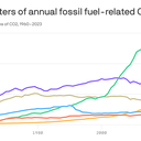
Reproduced from Global Carbon Budget, 2024; Chart: Axios Visuals

Just a month before President-elect Trump's inauguration, the Biden administration on Thursday put out new and more far-reaching national greenhouse gas reduction goals.

Why it matters: Even if, as expected, Trump withdraws the U.S. from the Paris Agreement for the second time and rolls back emissions regulations, the new targets were devised with some of his likely policies incorporated.


Zoom in: The U.S. Nationally Determined Contribution (NDC) โ€” the official name for the non-binding climate goals under Paris โ€” sends a signal to other countries ahead of Trump's arrival.

  • In particular, it puts pressure on China โ€” the world's top emitter โ€” to issue more aggressive targets that include methane and other warming contributors by the UN deadline.

The big picture: "American industry will keep inventing and keep investing. State, local, and tribal governments will keep stepping up," President Biden said in a video message released Thursday morning.

  • Senior administration officials said the numbers they are aiming for โ€” to slash greenhouse gas emissions economy-wide by 61% to 66% below 2005 levels by 2035 โ€” can be achieved with aggressive state, local and regional actions.
  • The proposal includes a methane emissions reduction target of 35% below 2005 levels by 2035.
  • During Trump's first term, governors and mayors helped put downward pressure on emissions while the executive branch favored more fossil fuel development and fewer regulations.
  • "Sub-national leaders in the United States can continue to show the world that American climate leadership is determined by so much more than whoever sits in the Oval Office," top U.S. climate diplomat John Podesta told reporters in a Wednesday press call.

But the new targets could be imperiled if congressional Republicans and the Trump White House succeed in reversing most of the emissions-cutting laws and regulations enacted during the past four years.

  • That includes a broad repeal of the Biden climate law, also known as the Inflation Reduction Act.
  • The Paris Agreement requires that countries submit new NDCs by mid-February.

Yes, but: The targets come even though the U.S. isn't yet on track to meet its current guideposts โ€” laid out in 2021 โ€” of cutting emissions by 50% to 52% below 2005 levels by 2030.

  • According to calculations by the Rhodium Group, the U.S. is currently on course to cut emissions by 32% to 43% relative to 2005 levels by 2030.
  • This could drop considerably, though, to 23% to 34% below 2005 levels if EPA emissions regulations are repealed along with other measures, potentially including a whole-scale repeal of the sweeping Biden climate law.
  • According to Podesta, the new goals would put the country on a linear, or slightly steeper, path to achieving its longer-term objective of net zero emissions by 2050.

By the numbers: Independent research shows the administration's target ranges are within reach but would be more difficult to achieve in the face of comprehensive rollbacks at the federal level.

  • In fact, additional actions would be needed to achieve the previous goals for 2030.
  • According to Rhodium's analysis, for example, the U.S. is headed for a 38% to 56% reduction in greenhouse gas emissions below 2005 levels by 2035. But this could be reduced to between 24% to 40%, depending on federal policies.
  • The group's calculations of the impacts of rollbacks and repeals show that federal action alone could add 1 billion tons of CO2 emissions. For comparison, last year the U.S. emitted 4.9 billion tons of CO2 from burning fossil fuels, such as gas, coal and oil.

Separate research from the University of Maryland found that "strong leadership" from non-federal actors could get the U.S. to between a 54% to 62% emissions reduction target relative to 2005 levels by 2035.

  • This built on previous work comparing emissions scenarios that incorporated various non-federal and national actions.

Zoom out: The details on the new U.S. goals come at a time when fundamental questions are being asked about whether the UN negotiations process is still able to address mounting environmental challenges.

What they're saying: "The value of submitting the NDC is to send a clear signal internationally about this administration's commitment to the Paris Agreement and especially to set a strong benchmark for U.S. states, cities and other stakeholders to pursue," David Waskow of the World Resources Institute told Axios.

The bottom line: The new U.S. targets lie somewhere between symbolic and serious, given the potential for Trump to affect emissions more radically than anticipated.

Warm winter days surge across Europe, North America and Asia

17 December 2024 at 05:31
Data: Climate Central; Map: Jacque Schrag/Axios

Winters are rapidly warming across the Northern Hemisphere because of human emissions of greenhouse gases from burning fossil fuels, a new report shows.

  • This is now being seen in many more days with temperatures above freezing.

Why it matters: More warm winter days means fewer opportunities for winter recreation and can have knock-on effects on water supplies during the following warm season.

The big picture: Climate change has added at least an additional week of winter days with temperatures above freezing each year during the past decade in more than one-third of 123 countries analyzed, researchers found.

  • The analysis compares recent trends with what would be expected to occur in a world without increasing amounts of heat-trapping greenhouse gases.

Zoom in: While previous analyses have looked at winter warming rates in the U.S., the new work โ€” from the climate science and communications group Climate Central โ€” covers the entire Northern Hemisphere.

  • It specifically zeroes in on the increase in the number of days during which temperatures remain above freezing during meteorological winter, which spans from December through February.

What's especially unique about this report is the attribution aspect.

  • Rather than only describing trends, the authors used published research and an in-house tool known as the Climate Shift Index to pin the increase in warm winter days directly to climate change.
  • About 44% of cities analyzed saw at least an additional week's worth of days above freezing each year due to human-caused climate change, the report found.
  • The cities with the greatest increase in warm winter days are located in Europe, which is the world's fastest-warming continent, and Asia.
  • Fuji, Japan, Khujand, Tajikistan and Turin, Italy each have gained 30 or more days during winter with above freezing temperatures annually during the past decade, owing to human-caused climate change, the analysis found.

The intrigue: In the U.S., 28 states and 63% of cities analyzed experienced at least a week of what the group terms "lost winter days" each year during the past decade due to climate change.

  • Boston has gained 14 winter days with above freezing temperatures each year during the past decade from climate change, the report found.
  • New York City has gained 13 lost winter days each year during the past decade, while Chicago and Milwaukee have picked up 12 such days thanks to climate change, and Washington, D.C., has gained 11, the report found.

The Climate Shift Index (CSI) is based on peer-reviewed methods, though the new analysis itself has not been peer reviewed.

  • The CSI tool allows climate scientists and the public to see how long-term, human-caused climate change is manifesting itself in present-day weather conditions, on land and at sea.
  • The trends the new analysis depicts match other data on winter temperature trends, which show that in many places, the cold season is warming faster than other times of the year.

By the numbers: Europe stands out as the global winter hot spot, with Denmark, Estonia, Latvia and Lithuania each seeing an average of at least three additional weeks of lost winter days due to human-caused climate change.

  • Nineteen countries โ€” including Germany, Poland, the Czech Republic and Belgium โ€” have seen at least two additional weeks' worth of above freezing days during the past decade, compared to what would have happened in the absence of global warming.
  • Climate change added between one to two weeks' worth of above freezing winter days each year during the past decade in France, Italy, Japan, the Netherlands, Spain and the U.K., the research found.

Yes, but: Typically, attribution studies show how climate change altered the likelihood of a particular extreme weather event.

  • But researchers claim that Climate Central's CSI tool can be used to estimate what temperatures would be in the absence of climate change with considerable precision.

The bottom line: Winters are warming, and winter days that dip below freezing are becoming more rare.

Global climate records in 2023 and 2024 defy scientific explanation

16 December 2024 at 05:22

The year is closing out with more global temperature records that, in aggregate, largely defy what many climate scientists expected for 2024.

Why it matters: Among the potential factors driving this year's โ€” as well as 2023's โ€” record warmth is the unsettling possibility that global warming is accelerating and the planet's climate behaving differently than expected.


  • If so, the climate scenarios that form the basis for countries' decarbonization goals could be faulty, with higher warming levels and greater societal consequences likely to arrive sooner than expected.

Driving the news: New data from NOAA, NASA and the EU's Copernicus Climate Change Service shows that the planet just had its second-warmest November on record.

  • These centers use different methods to track global average surface temperatures. They agree that 2024 is on track to be the planet's hottest year in well over a century of instrument record-keeping โ€” and likely at least 125,000 years when including tree rings and ice core data.
  • Copernicus, in fact, is out front in saying that 2024 may end up close to 1.6ยฐC (2.88ยฐF) above the pre-industrial average, exceeding the Paris Agreement's most ambitious target for a single year.
  • The 1850-1900 average is used as a baseline to approximate the period before the addition of greenhouse gases from burning fossil fuels such as coal, oil and gas.

By the numbers: According to the new Copernicus data, November was the 16th out of the past 17 months during which global average surface temperatures exceeded the 1.5ยฐC target relative to pre-industrial temperatures.

  • Separately, NOAA found that so far this year, six continents have had their warmest temperatures on record for the year so far, while Asia has ranked second-warmest.
  • During November, a record 10.6% of the world's surface had a record high monthly average temperature, beating the previous milestone set in 2023, NOAA found.
  • In addition, the ratio of warm temperature records to cold temperature records set globally during the month was about 50-to-1. That was roughly equal to November 2023 and an increasingly common occurrence in recent years, but largely unheard of prior to about 2010.

The intrigue: At the American Geophysical Union conference in Washington last week, top climate researchers discussed how to account for the steep, as yet incompletely explained warming spike seen during 2023 and 2024.

Between the lines: At the end of a Dec. 10 session on the causes of the 2023 and 2024 warming spike, NASA climate scientist Gavin Schmidt asked for a show of hands from those attending the year's largest climate science conference.

  • Only a smattering went up when Schmidt asked them to agree with the statement: "We have understood the anomalies in '23 and '24 with all of the information that has been presented here and that exists elsewhere."
  • Instead, the overwhelming majority backed the position that a sufficient explanation hasn't been offered and more research is needed.
  • "There is something to explain and there is still work to do," Schmidt said.

The bottom line: While there's virtually zero uncertainty that 2024 will be the hottest on record, plenty of unnerving debate exists regarding how and why this happened โ€” and what it means for the near future.

Hundreds feared dead after worst cyclone in 90 years slams French territory of Mayotte

15 December 2024 at 20:23

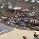
Officials in the French Indian Ocean territory of Mayotte estimate Tropical Cyclone Chido killed hundreds of people after the worst storm in 90 years struck the Indian Ocean archipelago.

The big picture: Mayotte hospital officials confirmed Tropical Cyclone Chido killed at least 11 people and wounded some 250 others on Saturday, but a top Mayotte official told local news outlet Mayotte La 1ere Sunday he expects the death toll to rise exponentially.


  • "I think there will certainly be several hundreds, maybe we will reach a thousand, even several thousands," prefect Francois-Xavier Bieuville said.

Driving the news: Tropical Cyclone Chido was at least the equivalent of a Category 3 hurricane in the Atlantic when it made landfall in Mayotte, per the U.S. military's Joint Typhoon Warning Center.

  • It was possibly stronger since it was so compact.
  • Surface wind readings of higher intensity suggest it was stronger from the storm, which also brought powerful winds and heavy rains to Mozambique when it made landfall on Sunday.
  • During the passage of the cyclone in Mayotte, 140 mph winds were recorded in the eye wall at Pamandzi on Mayotte's island of Petite-Terre, per a post to X by the weather agency Mรฉtรฉo-France.

State of play: French President Emmanuel Macron said on X that he's closely monitoring the situation on Mayotte โ€” which is the poorest territory in the European Union, with some 77% of people living below the national poverty line.

  • "Our island is at this moment deeply affected by the most violent and destructive cyclone that we have seen since 1934," Bieuville said on Facebook Saturday. "Many of us have lost everything."
  • European Commission president Ursula von der Leyen said on Bluesky that "Europe stands alongside the people of Mayotte in this terrible ordeal" and the EU was "ready to provide support in the days to come."
  • Phone and internet networks were still disrupted on Sunday, as French Interior Minister Bruno Retailleau prepared to visit Mayotte on Monday.

Between the lines: Studies show that climate change is increasing maximum wind speeds of hurricanes and causing them to intensify more rapidly.

These storms are the same type of weather system, but with different terminology depending where they occur.

  • Hurricanes and typhoons form in the Atlantic and western Pacific, respectively. Cyclones occur off the southeastern coast of Africa, among other locations.

In photos: Cyclone Chido causes widespread destruction in Mayotte

The French Interior Ministry says national police officers have been deployed to help in the cleanup and prevent potential looting. Screenshot: French National Police/French Interior Ministry/X
Residents survey damage on Dec. 15 after homes were destroyed by the cyclone. Photo: Kwezi/AFP via Getty Images
A classroom of an elementary school in Mayotte's capital Mamoudzou on the island of Grande-Terre on Dec. 15, which was struck by the storm a day earlier. Photo: Daniel Mouhamadi/AFP via Getty Images
An inter-island barge is stranded among debris in Mamoudzou on Dec. 15 following the cyclone. Photo: Kwezi/AFP via Getty Images
Residents among piles of debris of metal sheets and wood strewn across a road after Cyclone Chido struck Mayotte. Photo: Kwezi/AFP via Getty Images

Go deeper: Why climate change hits poorest countries hardest

Editor's note: This is a breaking news story. Please check back for updates.

โŒ
โŒ